Collection Item

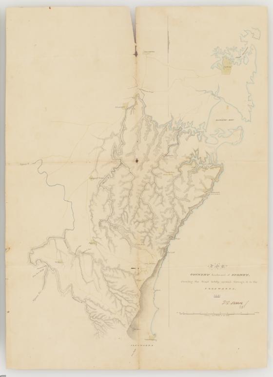
[The] country southward of Sydney, shewing the road lately opened through it to the Illawarra, T.L. Mitchell, manuscript map, 1845 1845
Area: from the source of the Nepean River to Port Hacking, and from Parramatta and Port Jackson to Wollongong. Map shows, coastline, mountains, forests, small farms, grass hills, boat harbour, marshes, bays, Parramatta, Lansdowne Bridge, Liverpool, George's River, Woronora River, Nepean River, Cook's River, Dahlia Creek, Cordeaux River, Cataract River, Campbell Town, Port Hacking, Wattamolla, Bulgo, Coal Cliff, Bulli, Mt. Keira, Broughton's Pass, Jordan's Pass, Wilton, and Pheasant's Nest.
Call Number:
Cb 84/18
Published date:
1845