Collection Item

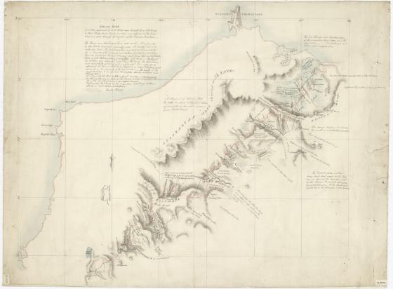
H. Hume's sketch of a tour performed by W. H. Hovell and himself from Lake George to Port Phillip, Bass's Straits, at their own expense in the years 1824 and 1825 through the request of Sir Thomas Brisbane [cartographic material] [1826?]
Manuscript map. Ink and wash. Colours. Mercator's projection. South to top of sheet. Watermarked, J. Whatman, Turkey Mill, 1825.
Shows routes out and back, with surrounding features, and outline of coast. Journey shown to terminate at Port Phllip. This is the work of a professional draftsman, working rather quickly. It is thought to have been drawn up in the Lands Department from Hume's orginal map, which he entered during the journey on a skeleton map provided by the Governor, or was copied from such a copy. This map is described by E. Scott as 'Hume's own sketch-map, which he gave to Sir Thomas Mitchell but it is more likely that the draftsman was Mitchell himself than Hume. The map was among some of T.L. Mitchell's papers received about 1920 by G.V.P. Mann, son of Mitchell's daughter, and was by him passed on to Sir William Dixson. See accounts by E. Scott in Journal of the Roy. Aust. Hist. Soc. v.7 1921, p.293, and in Vic. Hist. Mag., v.10 1925, p. 131. Since the terminus is shown as Port Phillip, the dating of the map is bound up with the controversy as to when Hume first knew it was not Westernport. The map can hardly be earlier than the date attributed. It is unlikely that more than the one copy was taken directly from Hume's original at the one time, and if so it cannot be later.
Online images available via the State Library of NSW: http://acms.sl.nsw.gov.au/album/albumView.aspx?itemID=888261&acmsid=0 ; Digital Order No. a1528603.
Call Number:
Cb 82/24
Published date:
[1826?]