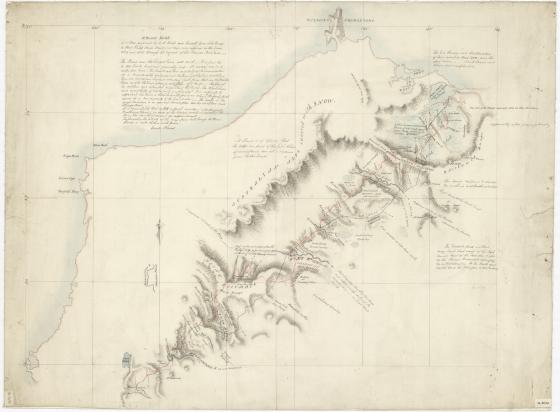
H. Hume's sketch of a tour performed by W. H. Hovell and himself from Lake George to Port Phillip, Bass's Straits, at their own expense in the years 1824 and 1825 through the request of Sir Thomas Brisbane
In 1824 William Hilton Hovell (1786-1875), and Hamilton Hume (1797-1873) set out from Hume's property near Gunning on an overland expedition to Westernport. On 16 December 1824 they sighted Corio Bay in Port Phillip, which they believed to be Westernport. Their journey opened the way for the settlement of Port Phillip.
No original map documenting the journey has survived. This manuscript map of the journey is believed to be a copy possibly sketched by Thomas Mitchell from a rough sketch provided by Hume to Mitchell following the completion of the journey. The arrows mark both the outward and return journeys. Sir William Dixson acquired the map through Thomas Mitchell's grandson. The Library holds additional information on the journey including Hovell's papers from 1811 - 1875.