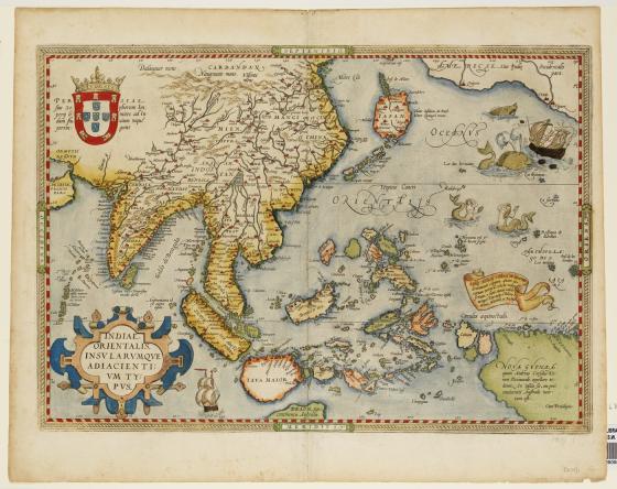
Indiae orientalis insvlarvmqve adiacientivm typvs 1584
From the atlas, Theatrum orbis terrarum[The Theatre of the Whole World], this map depicts New Guinea as a large land mass shown at the bottom right corner. In 1584 it was not known whether it was an island or part of a larger continent. Below Java is a mysterious reference; Beach, pars continentis Australis. Marco Polo had named a southern land mass beachsuggesting a possible southern continent.
This fascinating and beautiful map combines the factual with the fantastic. A growing interest by the Dutch in the East Indies’ trading potential is reflected in the detail of the islands of Java, Sumatra, and the Moluccas or Spice Islands. While in the Pacific Ocean (called Orientalis), mermaids attend to their hair and sea monsters cause havoc off the coast of America.