Collection Item

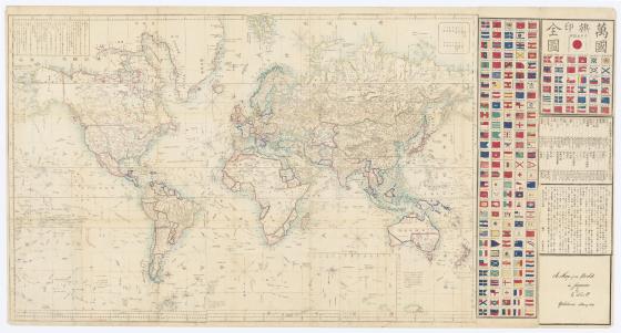
A map of the world in Japanese / by Ed. Schnell.
Shows the tracks of important explorers, among them Cook and LaPerouse and hand-coloured boundaries in blue and red ink. Australia is shown divided in 'sections'; with New South Wales, Victoria, Tasmania and most of South Australia in one section. Queensland, most of the Northern Territory and Western Australia are drawn into another section. The south western part of Western Australia is sharply separated along a diagonal line. The northern most part of the Northern Territory, from the Gulf of Carpentaria to the approximate area of Quion Island, is shown in a separate section or boundary.
Relief shown by hachures.
Includes text, distance chart, and chronological list of explorers. Has coloured illustrations of flags in the margin.
Call Number:
M4 100/1862/1