Collection Item

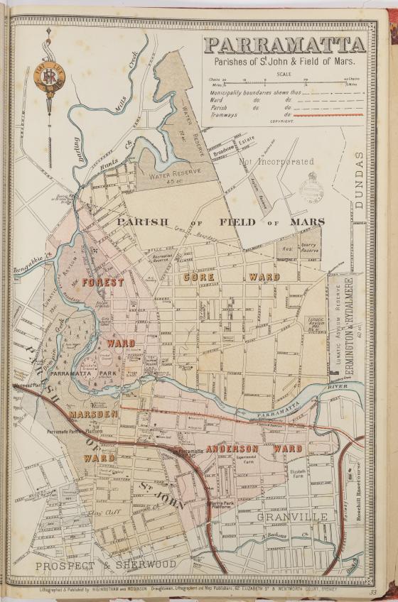
Parramatta suburban map ca. 1890
This map shows Parramatta in the 1890s. Land in Argyle Street was selling for around 1 pound per foot at the time.
It comes from an atlas of Sydney suburbs showing municipal and ward boundaries published by Higinbotham & Robinson.
Collection Item Type:
map
Call Number:
F981.1/H
Published date:
ca. 1890
Copyright Information:
Out of copyright: This image may be used freely without requesting permission.
Please acknowledge: This image is from the collections of the State Library of New South Wales.