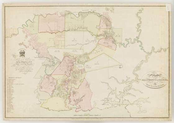
Plan of the allotments of ground, granted from the Crown in New South Wales / J. Burr & G. Ballisat. 1814
This map is dedicated to 'Admiral Hunter, late Governor of New South Wales' who had completed his term in September 1800.
From 1791 to 1831, the Governors of New South Wales issued free grants of land on behalf of the Crown to individuals to encourage and advance the settlement of the Colony. Evidence of ownership of these land grants was provided by a document known as a Crown grant.
This map shows grant lot numbers and acreages and was intended to accompany the booklet, An Accurate list of the names of the land-holders in the colony of New South Wales pointing out the number of acres in each district as granted from the Crown, corrected to 1813. This listing of individuals and the size of their land grants in the Sydney region includes women who had received grants and should be read alongside the map in order to locate the lot numbers and districts.
Several now redundant place names are included on the map. At point H: ‘Bulanaming’ was used up until the 1820s for the area between Sydney and the Cooks River and the Parish of Petersham. The Green Hills region was named Windsor by Governor Macquarie in 1810; however this name had perhaps not yet been fully established in the Colony or on this 1814 map.
Liberty Plains now encompasses the Municipality of Auburn and includes the modern suburbs of Lidcombe, Auburn, Newington and Homebush Bay.
With the first land grants given along the eastern side of the Nepean River, this settlement became known as the Evan district; however by 1829 the area was referred to as Penrith.