Collection Item

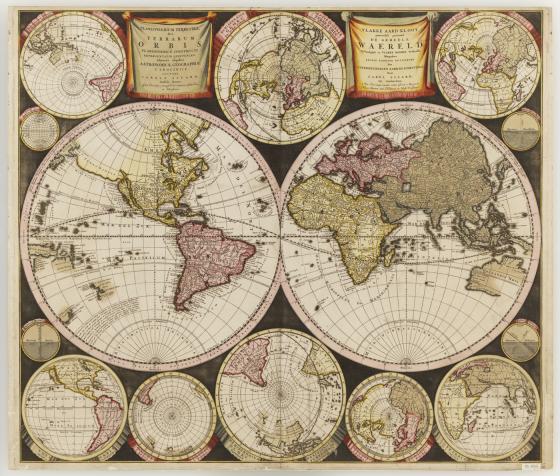
Planisphaerium terrestre 1696
This is Carel Allard's second world map, published in his Atlas Minor of 1696 and hisAtlas Major of c.1705. Allard has depicted twin central hemispheres which are surrounded by eight smaller projections which illustrate the world from various perspectives. The Australian mainland is named Hollandia Nova with a partial coastline shown in both hemispheres from Great Australian Bight to Carpentaria.(Cape York Peninsula), with an additional portion of coastline named "Quri Regio". Tasmania is named Antoni van Diemens Land showing part of its southern coastline. New Zealand is named Zelandia Nova and only a partial portion of coastline is depicted.
Call Number:
Cb 68/2
Published date:
1696