Collection Item

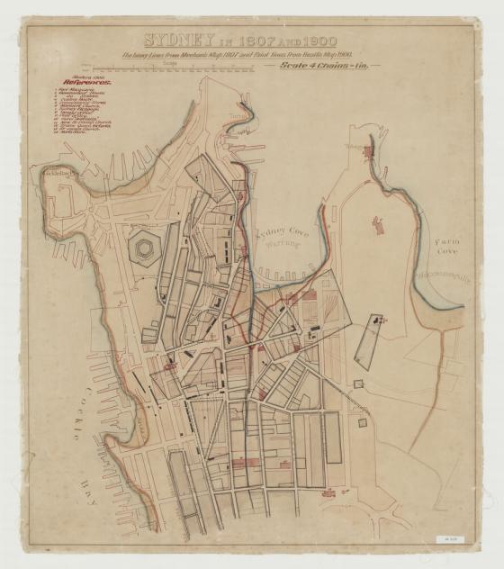
Sydney in 1807 and 1900: the heavy lines from Meehan's map 1807 and faint lines from Health Map 1900, Sydney : Government Printing Office, 1900 1900?
Like an early map overlay, this 1900 map depicts two maps of Sydney Cove superimposed over each other. The red lines indicate the original coastlines depicted in James Meehan's 1807 map and the dark lines indicate the street blocks existing in 1807 with a 1900 map indicating streets, buildings and wharves.
Call Number:
Z/Cb 90/8
Published date:
1900?