Factors that shape places: Circular Quay
Key inquiry question #1
How do people influence places and the management of spaces within them?
Content
Humans shape places
Students:
- investigate how people influence places, for example: (ACHGK029)
- description of who organises and manages and looks after places (ie. local and state governments)
- identification of ways people influence places and contribute to sustainability (ie. roads and services, building development applications, local sustainability initiatives)
- examination of a local planning issue; the different views about it and a possible action in response to it
Background Notes for Teachers
Learning activities
This set of learning experiences focuses on Circular Quay, Sydney, as a case study for the topic Humans Shape Places. Students follow the Geographical Inquiry Process guided by inquiry questions of What is? Where is?, Why there? and Why care? These questions are behind a definition of geography put forward by Charles F. Gritzner (2002).
Defining Geography: What is Where, Why There, and Why Care? by Charles F. Gritzner, Journal of Geography101, No. 1 (January/February 2002), pp. 38-40.
History of Circular Quay
“Circular Quay, at the head of Sydney Cove, has been the focal point for the interface between the town and the harbour since the arrival of the First Fleet in 1788. The quay was constructed in phases from the 1830s until the 1860s to allow for commercial shipping to berth alongside wharves and warehouses that once dominated all three sides. From the later 1890s and after the formation of the Sydney Harbour Trust in 1900 ferry commuter wharves came to dominate. From this time Circular Quay grew as a commuting hub, with both ferries and trams terminating here. The construction of a railway station as part of this transport network was the next logical step in the quay's development. From the 1960s and 1970s, with the construction of the Overseas Passenger Terminal nearby and the Sydney Opera House, Circular Quay also grew in prominence as a tourist destination.” - NSW Environment Department.
Upgrade proposal
On 28 September 2015 the NSW Government announced a proposal to upgrade Circular Quay. “Upgrades proposed for Circular Quay include more modern, double storey and accessible wharves plus new retail facilities” with construction expected to commence in 2019.
NSW Government vision for Circular Quay, 28 September 2015
Student Activities
Sydney Harbour and Circular Quay
Students examine a photo of Circular Quay and discuss its environment and geography
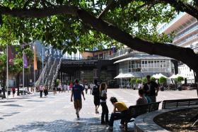
Where is Circular Quay and how do you get there?
Students examine the photos and create transport routes and write descriptions for tourists.
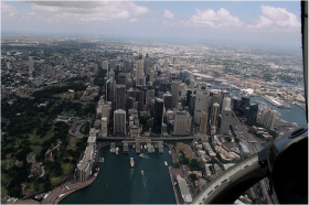
What is Circular Quay and how is it used?
Students undertake a virtual fieldwork study of Circular Quay and create a survey for family members
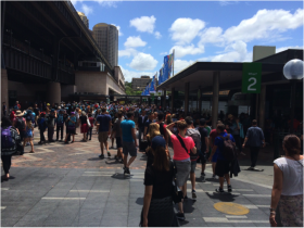
Why is Circular Quay there?
Students examine historic photos of Circular Quay and the surrounding area and discuss how it came to be created.
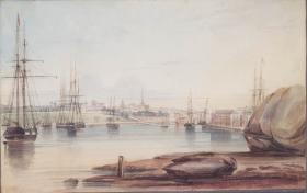
Why care about Circular Quay?
Students view animated concept designs of proposed upgrades to Circular Quay and discuss the major changes proposed and the potential impacts of the changes.
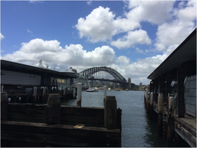
Modifying and managing Circular Quay for the future?
Students write a one page persuasive letter outlining their views on the Government’s proposed upgrades to Circular Quay and making recommendations for how the design could be improved or changed, if appropriate.
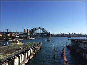
Activity: Teachers notes
Engagement and questioning – Sydney Harbour and Circular Quay
Sydney’s Harbour Bridge and Opera House are iconic landmarks of Sydney that feature in major events such as New Year’s Eve, Australia Day and the Vivid Light Festival. Located between them is Circular Quay: the terminal for Sydney’s ferry services and a popular harbour-front tourist destination in its own right.
Acquiring and representing geographical information – Where is Circular Quay and how do you get there?
Students use Sources 2 to 4 and Google Maps to locate Circular Quay, Sydney Harbour Bridge, Sydney Opera House and the nearest train stations and bus stops.
Students plot the train stations and bus stops on the map in Source 4. They also write a description for tourists of the location of Circular Quay to accompany the map. Students include information on public transport services to Circular Quay.
Acquiring and representing geographical information – What is Circular Quay and how is it used?
On land originally known as Warrane by the traditional Aboriginal owners, the Eora people, Circular Quay was built by convicts between 1837 and 1844 on the site of the first colonial settlement at Sydney Cove. Sandstone blocks were used to construct an artificial shoreline on what were originally mudflats. It was first known as Semi-Circular Quay until the Tank Stream was piped and the constructed wall was extended around the western shore in the 1850s and 60s.
Circular Quay was originally built as a port for commercial shipping. When these operations became too large for the area in the 1880s they were moved to Darling Harbour. Circular Quay became a commuter hub for passenger ferries, trams and pedestrians. Located on the harbour front in close proximity to The Rocks area, Harbour Bridge and Opera House, Circular Quay has gained increasing popularity and significance as a Sydney tourist destination. In September 2015 the NSW State Government announced plans for a $200 million upgrade with construction expected to commence in 2019.
Virtual field study
Using Sources 5 to 8 and supplementary sources such as personal experiences, YouTube videos, images and tourist information, students undertake a virtual fieldwork study of Circular Quay. Students should view the site from the all directions and from the water, land and air. Students draw a photo sketch of Source 9 and record features and uses in Table 1.
Uses survey
Students design a questionnaire to survey class and family members on their personal experiences of visits to Circular Quay. Sample survey questions:
- Have you been to Circular Quay?
- How do you use Circular Quay? (eg catch a ferry, catch a train, for the views, entertainment, go for a walk, on the way to…)
- What do you like about Circular Quay?
- What challenges do you face when you go to Circular Quay?
- How could Circular Quay be improved?
Resources
Picture books
Alphabetical Sydney by Antonia Pesenti and Hilary Bell
Websites
Barrani: Sydney’s Aboriginal History, Circular Quay, Warrane
Upgrades proposed for Circular Quay
NSW Government vision for Circular Quay, 28 September 2015
NSW Syllabus for the Australian Curriculum Geography K–6
A student:
- GE3-1 describes the diverse features and characteristics of places and environments
- GE3-2 explains interactions and connections between people, places and environments
- GE3-3 compares and contrasts influences on the management of places and environments
- GE3-4 acquires, processes and communicates geographical information using geographical tools for inquiry
Acquiring geographical information
- develop geographical questions to investigate and plan an inquiry (ACHGS033, ACHGS040)
- collect and record relevant geographical data and information, using ethical protocols, from primary data and secondary information sources, for example, by observing, by interviewing, conducting surveys, or using maps, visual representations, statistical sources and reports, the media or the internet (ACHGS034, ACHGS041)
Processing geographical information
- evaluate sources for their usefulness (ACHGS035, ACHGS042)
- represent data in different forms, for example plans, graphs, tables, sketches and diagrams (ACHGS035, ACHGS042)
- represent different types of geographical information by constructing maps that conform to cartographic conventions using spatial technologies as appropriate (ACHGS036, ACHGS043)
- interpret geographical data and information, using digital and spatial technologies as appropriate, and identify spatial distributions, patterns and trends, and infer relationships to draw conclusions (ACHGS037, ACHGS044)
Communicating geographical information
- present findings and ideas in a range of communication forms as appropriate (ACHGS038, ACHGS045)
- reflect on their learning to propose individual and collective action in response to a contemporary geographical challenge and describe the expected effects of their proposal on different groups of people (ACHGS039, ACHGS046)
- Place: the significance of places and what they are like(ie. characteristics of places on a global level).
- Space: the significance of location and spatial distribution, and ways people organise and manage spaces that we live in (ie. global patterns of spatial distribution; how people organise and manage spaces in their local environment).
- Environment: the significance of the environment in human life, and the important interrelationships between humans and the environment eg how the environment influences people and places; how people influence the environment; the effect of natural disasters on the environment.
- Interconnection: no object of geographical study can be viewed in isolation (ie. how environments influence where people live; ways people influence the characteristics of their environments; diversity of cultures and peoples around the world).
- Scale: the way that geographical phenomena and problems can be examined at different spatial levels (ie.environmental and human characteristics of places on local, regional and global scales; the effect of global events on people and places locally, regionally and globally).
- Sustainability: the capacity of the environment to continue to support our lives and the lives of other living creatures into the future (ie. extent of environmental change; environmental management practices; sustainability initiatives).
- Change: explaining geographical phenomena by investigating how they have developed over time (ie. changes to environmental and human characteristics of places).
Learning Across the Curriculum
- Sustainability
- Information and communication technology capability
- Critical and creative thinking
- Literacy
- Personal and social capability
- Civics and citizenship
- Work and enterprise