Why is Circular Quay there?
Topic: Factors that change environments: Circular Quay
This is the student activity 1 of 6 of the Factors that shape places: Circular Quay learning activity.
Task No. 1
Acquiring and processing geographical information – Why is Circular Quay there?
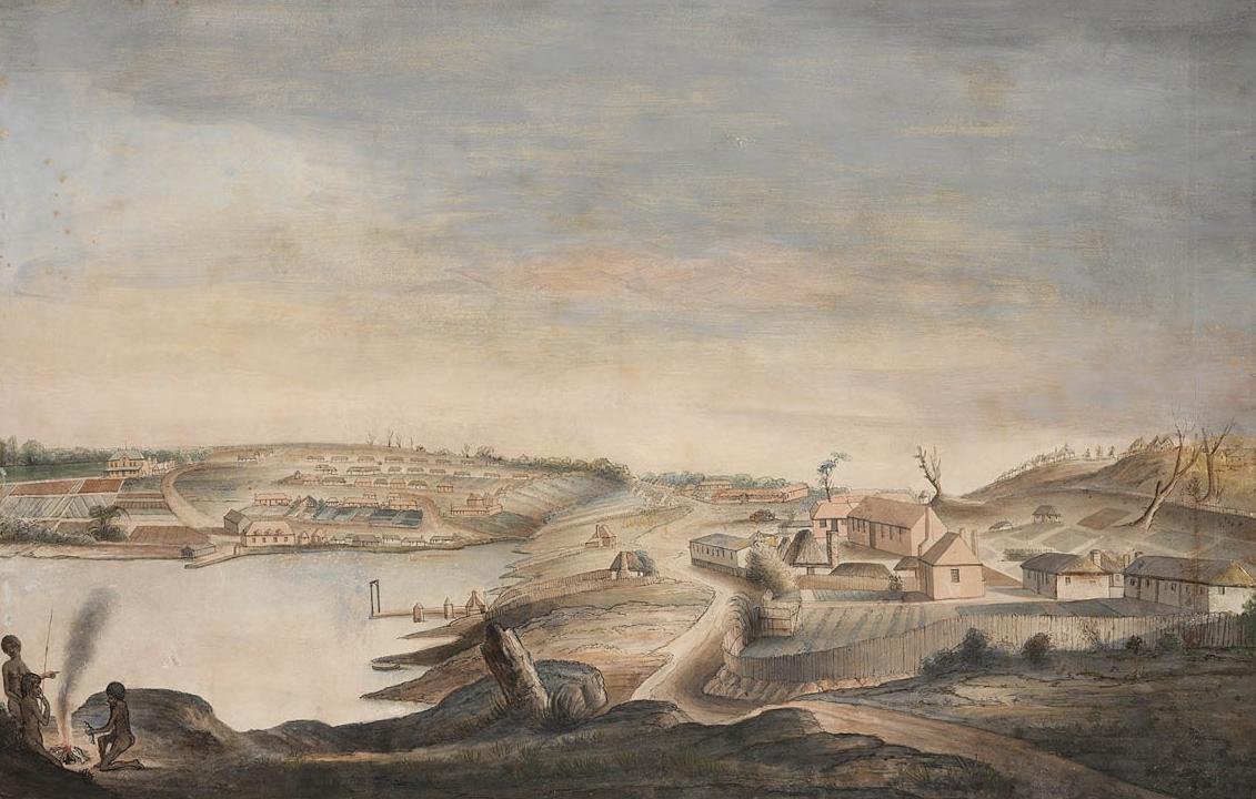
View of Sydney Cove / painted by Thomas Watling
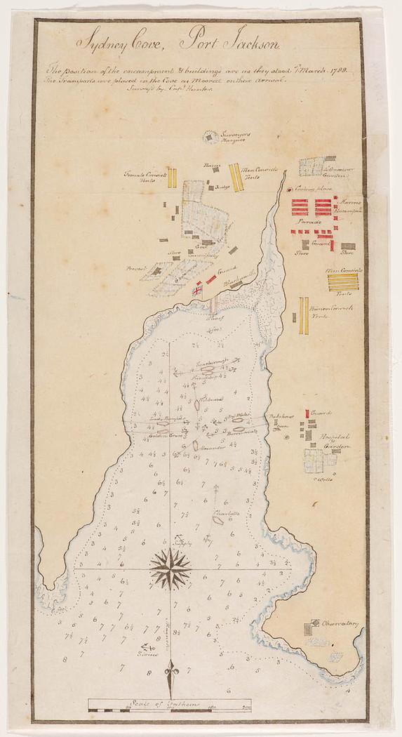
Sydney Cove, Port Jackson
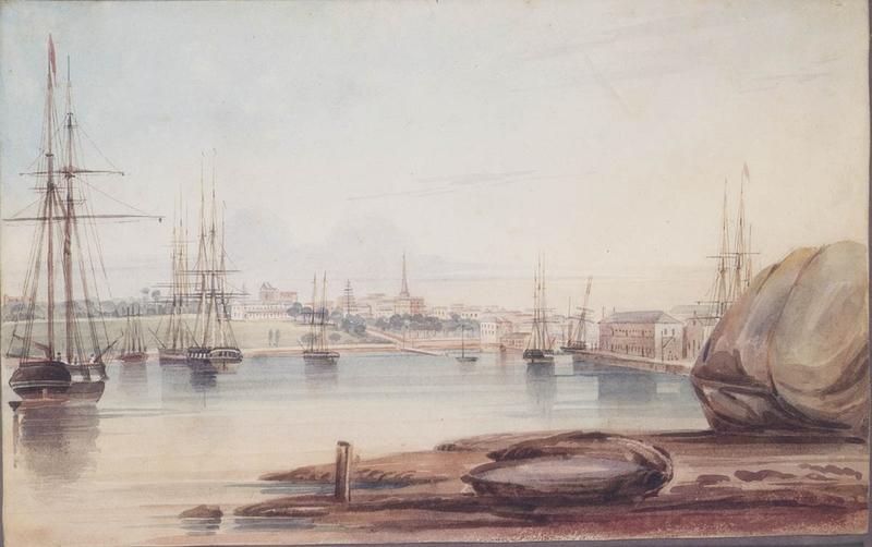
Sydney Cove from Dawes Point / watercolour by Frederick Garling
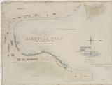
Plan of the Circular Quay including the Harbor Steamers Wharf, scheme for affording additional wharf accommodation at the Circular Quay

Plan of the Circular Quay including the Harbor Steamers Wharf, scheme for affording additional wharf accommodation at the Circular Quay, by John Gowlland, N. Lieut., R.N. ; (signed) Norman Selfe. John Thomas Ewing Gowlland, Sydney, 1873
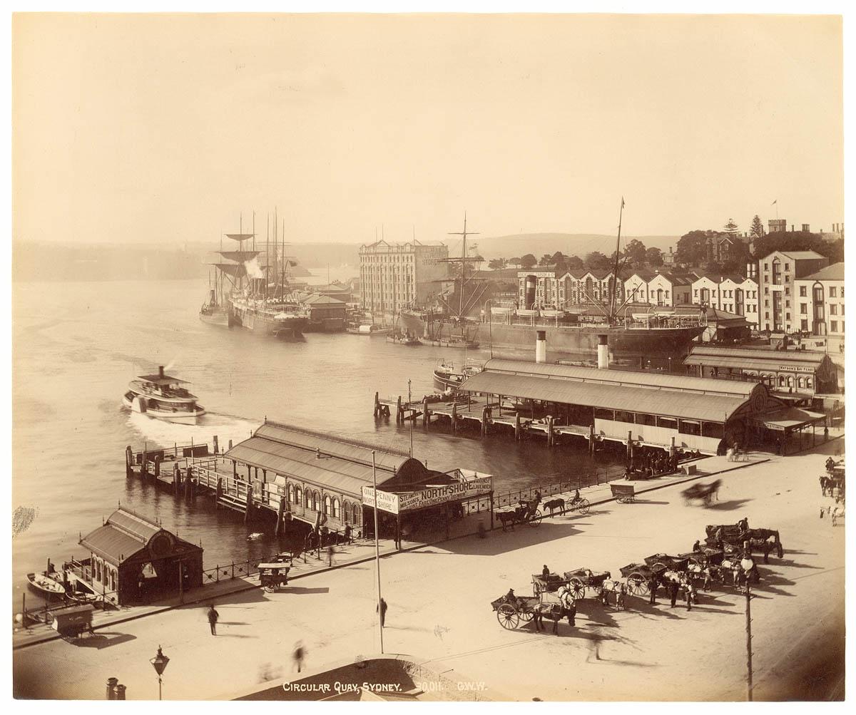
Circular Quay, Sydney
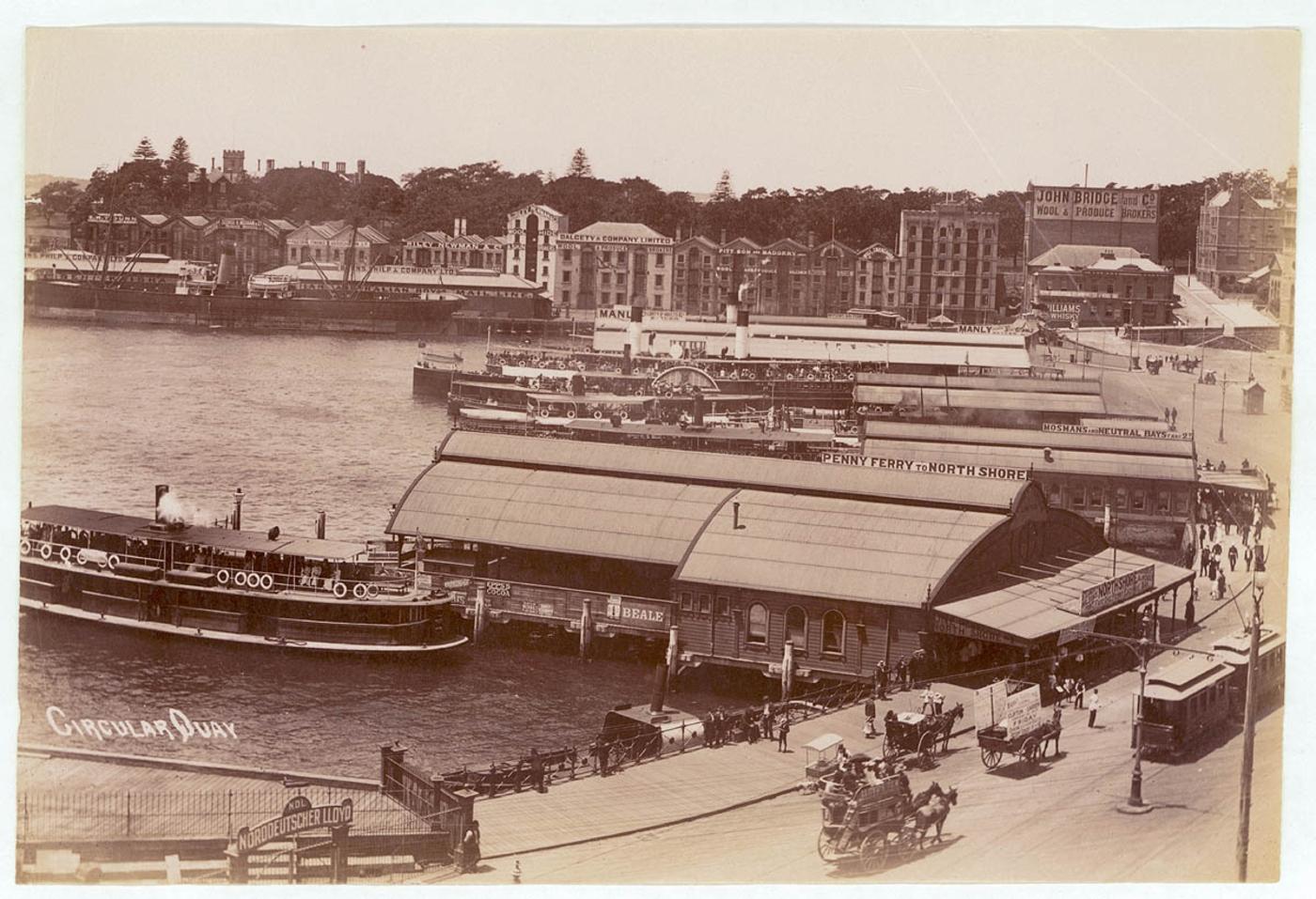
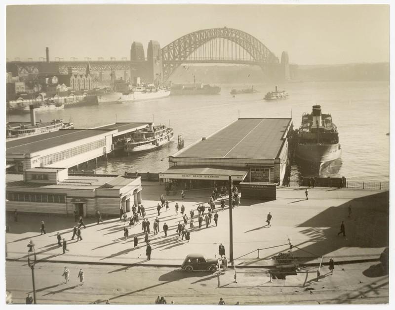
Circular Quay [looking east, showing ferries at wharves, electric trams and a steamship]
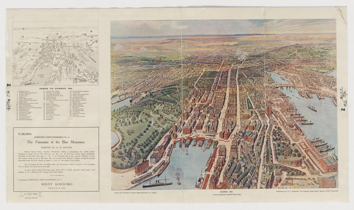
Aeroplane view of Sydney, 1914 : Looking southwards Botany Bay as it would be seen from an altitude of about 5,000 feet above North Sydney : With a key to principal places [Album view]
Item 24: Walkabout magazine : New South Wales photographs [Sydney housing, hotels, sugar, wheat, ferries & bridges, streets & parks, yachting]
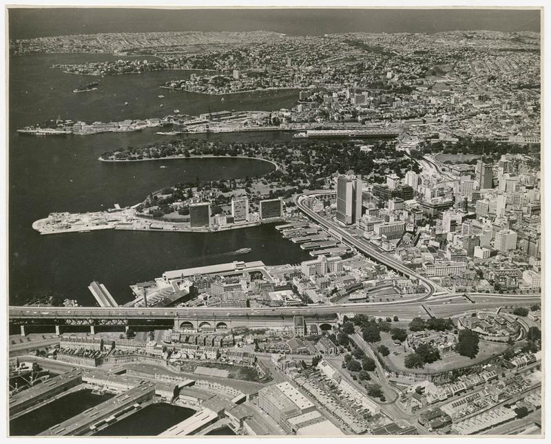
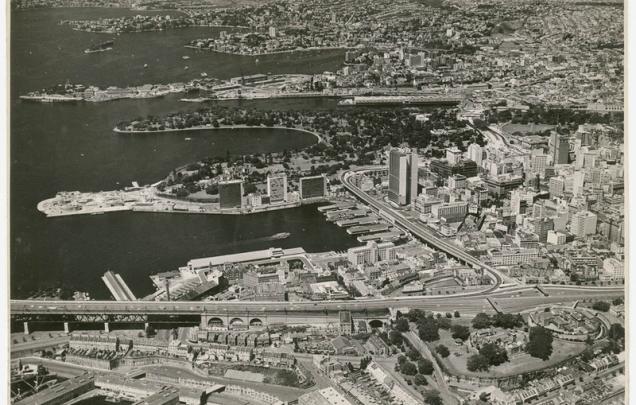
Aerial view of Circular Quay and Cahill Expressway, c.1963,
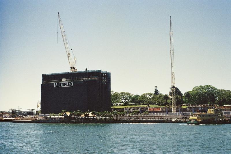
East Circular Quay Sydney Cove, 1995
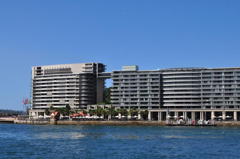
East Circular Quay, Sydney Cove, 2009
Examine sources 10 to 19 and research further to investigate the reasons Circular Quay was constructed and its shape, use and features over time.
Record the uses and changes to Circular Quay since British Colonisation in the table found in the downloadable resource.