Why is there continued settlement in the Shoalhaven River area? How has the natural environment influenced the settlement?
Topic: Environments shape places: Shoalhaven River area
This is the student activity 1 of 7 of the Factors that shape places: Shoalhaven river learning activity.

Task No. 1
Why is there continued settlement in the Shoalhaven River area? How has the natural environment influenced the settlement?
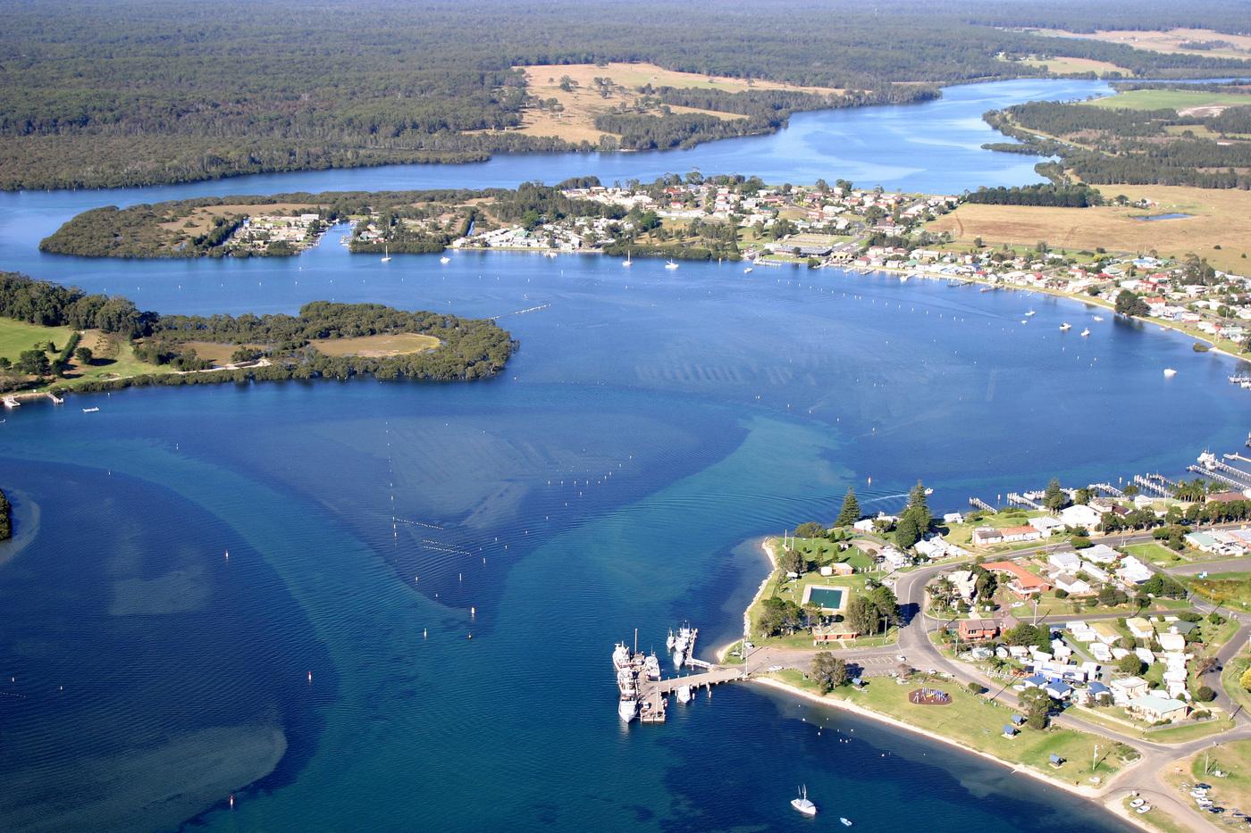
Aerial photographs of Greenwell Point, 2004 / by Daryl Jones
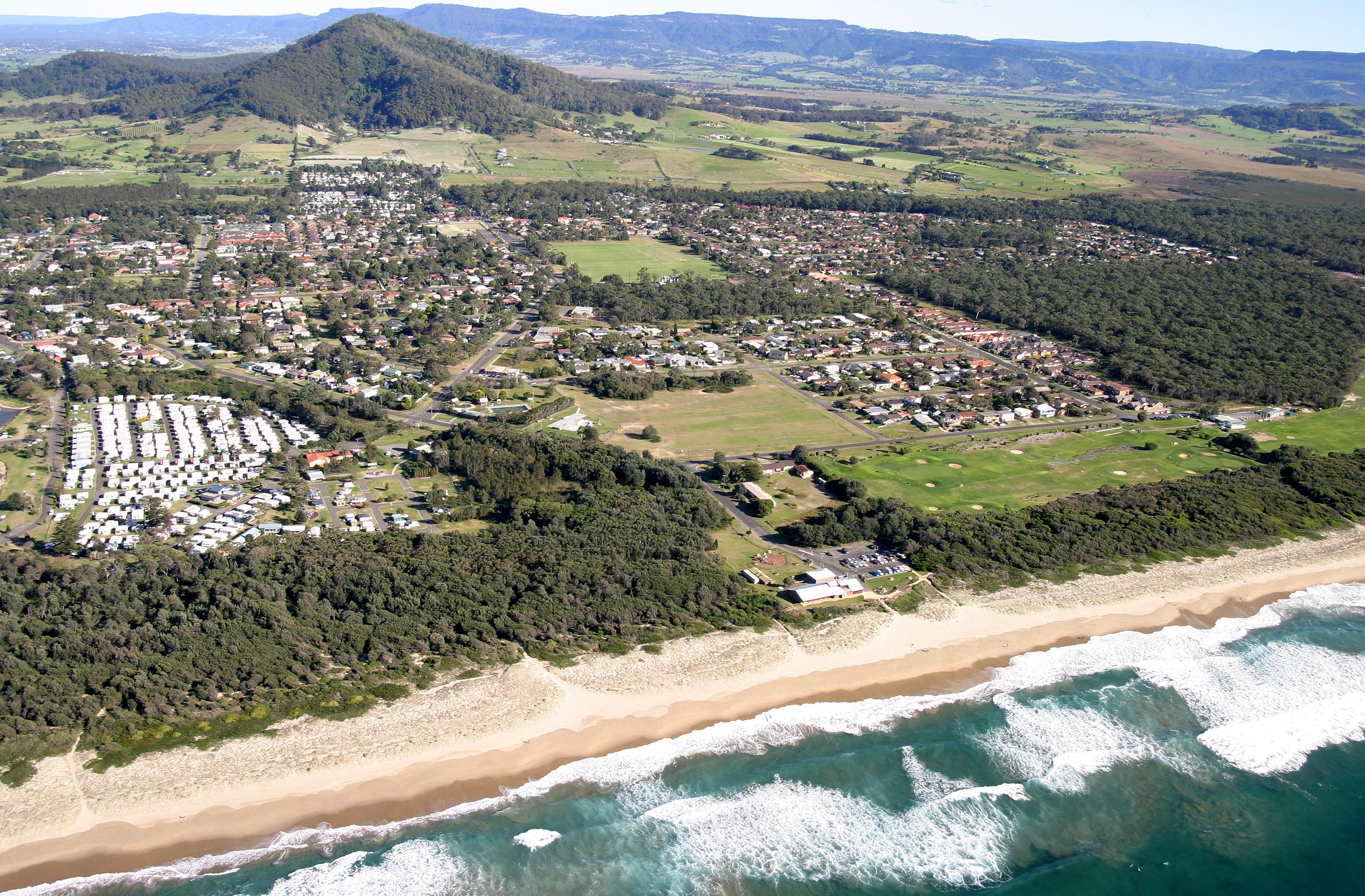
Shoalhaven Heads caravan park and beach, showing Coolangatta mountain in background, 2004, photographed by Daryl Jones
View Sources 14 and 15 and other aerial photos in the Daryl Jones aerial photographs collection in Source 16. Answer the questions below and complete Table 2.
Observe and discuss
- What natural and human features can you see in the images?
- What landforms can you see?
- What recreational facilities can you identify?
- Can you identify human activities using the steep hills?
- The Shoalhaven River area has a high risk of flooding due to the low-lying land on the flood plain and its proximity to the river and ocean. What activity can you identify from the sources that utilises the lower-lying land on the flood plain?
- Due to frequency of flooding in the lower-lying floodplain areas, people moved the main township to higher areas around the river. Identify these areas based on the urban area.
Infer and discuss
- Why haven’t the steep hills been cleared of trees?
- How would the wharves and river be used for leisure and commercial activities?
- Why would residents and tourists visit the beaches and forested areas?
- What food is being farmed in the estuary? What does this provide for residents and tourists?
- What natural features (landforms and climate) influence and support the settlement of the area? How?