The expansion of Sydney from early settlement to the present
This is the student activity 1 of 8 of the Factors that shape places: urban places learning activity.
Overlay map to represent expansion of Sydney
Using an overlay map, students will investigate urban areas and their expansion in Sydney from early settlement to the present.
Equipment: Printed map of Source 12, a satellite view of Sydney from Google Maps, two pieces of clear plastic sheets, marker pens and paper clips.
Base map
Print the map of Sydney from Google Maps in satellite view. This will become your base map. Each additional layer will be attached to this map using the paper clips. For each layer include a title, key, scale, directional point and source.
Layer 1: Sydney – Colonial settlement
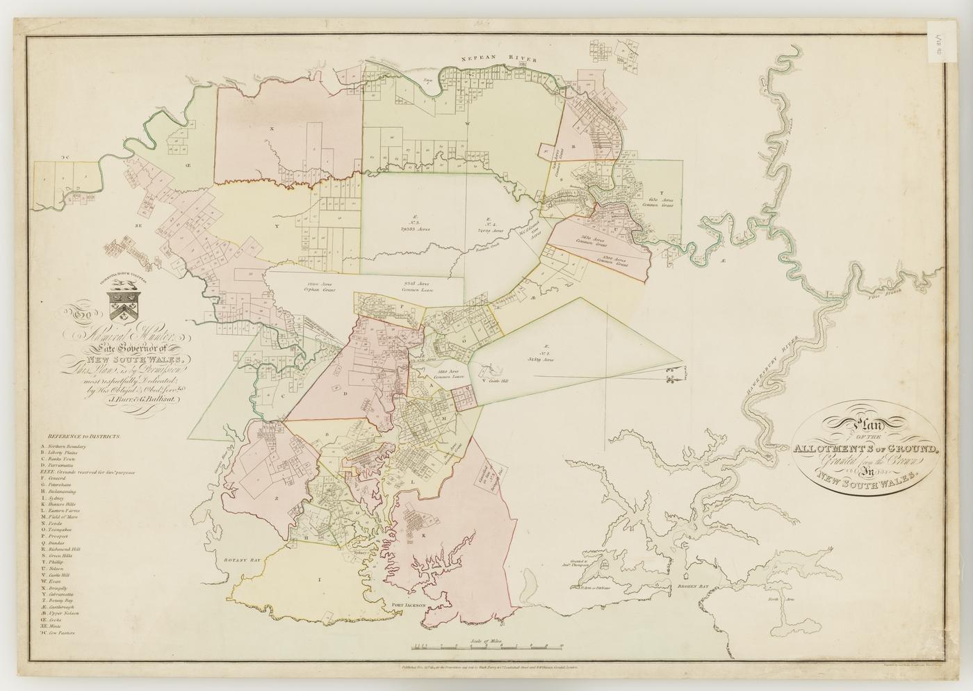
With reference to Source 12, locate, label and shade Sydney and Parramatta in grey. Using the rivers to help you locate the areas, shade the allotments in light green and the remainder in dark green. Use a key to indicate urban areas (grey), rural areas (light green) and natural areas (dark green).
Layer 2: Present-day Sydney
Using the base map of the satellite view of Sydney from Google Maps, trace and shade the urban areas (grey), rural areas (light green) and natural areas (dark green). Locate and label the four suburbs in Sources 7 to 10 and Sydney’s major centres: Bankstown, Blacktown, Camden, Castle Hill, Liverpool, Parramatta, Penrith, Rouse Hill and Sydney.
The future of Sydney's urban areas
Create a third layer on your overlay map showing your predictions for the expansion of Sydney. Shade in these areas.
Write a two minute speech locating the areas you predict will see further growth, the reasons why there will be growth in these areas and the change that will occur through the expansion of urban areas.
Optional activity: Formulate questions for further inquiry into a local planning issue
- What type of urban development is occurring?
- Where is it?
- Why is it located where it is?
- Why care? What impacts will this urban development have on our local community and what measures need to be addressed to protect human and natural places?