
Cook's maps
As well as the intriguing legacy of his journal observations, Cook also left a visual one, drawing maps of the journey as he went. Bound into the end of the Mitchell Library’s copy of Cook’s journal are several engraved maps based on Cook's drawings. These maps, including details of Botany Bay and the Endeavour River, were produced after the expedition returned to England, and it isn’t known when they were bound in with the log.
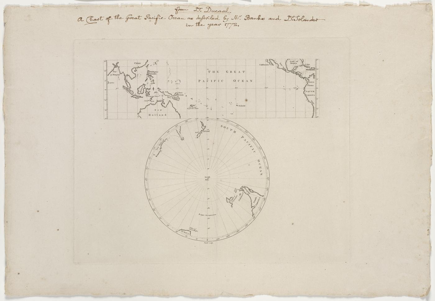
New South Wales on the map
In early 1772, Joseph Banks commissioned from John Bayly, engraver to the British Museum, an engraving of a 1770 chart that traced Captain James Cook's survey of the coastline of eastern Australia and of New Zealand.
Banks intended the map to highlight the achievements of the captain’s first voyage and promote Cook’s second expedition, illustrating regions yet to be explored including the Southern Ocean and polar regions. Eventually, Banks withdrew from the expedition and instead mounted an expedition to Iceland.
Inscribed with the name New South Wales, this is the first printed map that features the eastern coastline of Australia with the name Cook bestowed on it, along with the islands of New Zealand.
A decorative masterpiece
This beautiful first-edition map by European cartographer Antonio Zatta is the first decorative map to show Cook’s sea tracks in the Pacific.
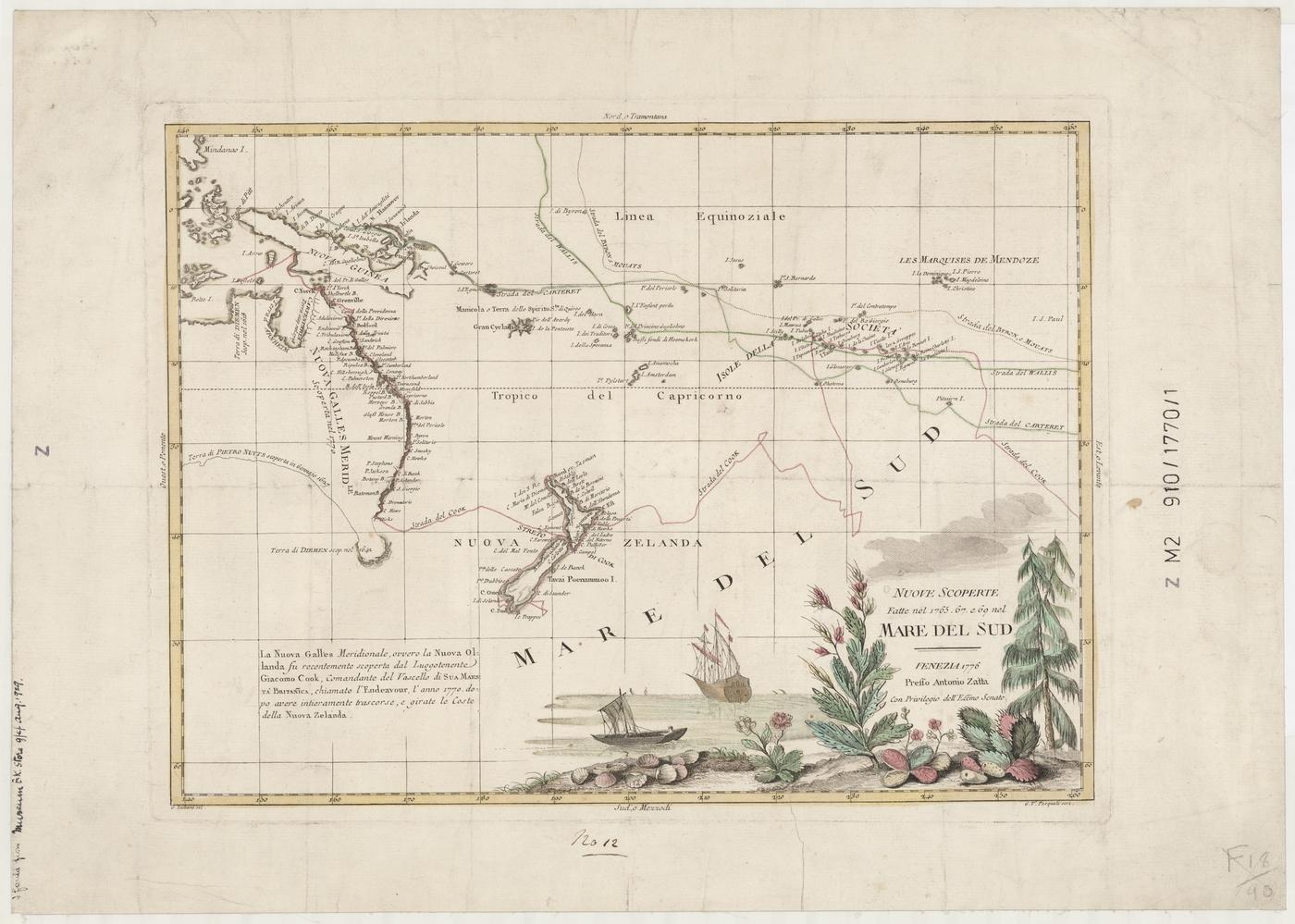
It records discoveries made during his Endeavour voyage to Australia, New Zealand, New Guinea and the South Pacific, during 1769–1770, as well as showing the tracks of Commodore Byron with Captain Mouat in 1765 and Samuel Wallis aboard the Dolphin, partnering Phillip Carteret commanding the Swallow in 1767.
The charting of the east coast of Australia and New Zealand is shown in detail, based on Cook’s map of the region, the ‘Chart of part of the South Seas’. The decorative hand-coloured vignette at the bottom of the map features a ship that is almost certainly Cook’s ship, the Endeavour. Antonio Zatta also published a beautifully produced set of atlases, Atlante Novissimo, which included the discoveries of Cook.