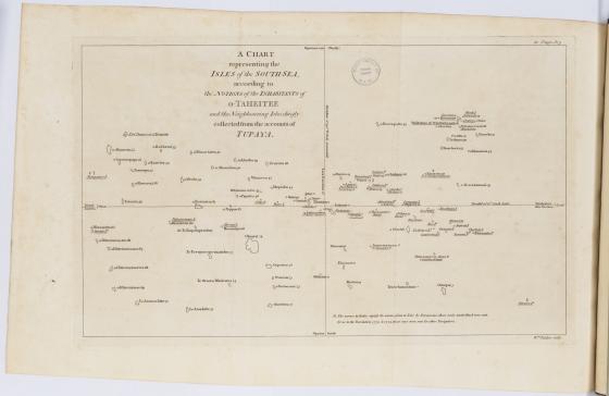
A chart representing the Isles of the South Sea … 1788
Tupaia was a talented navigator, scholar and artist from Raiatea in French Polynesia. He chose to join Cook’s voyage in 1769. His knowledge of Polynesian customs and language was invaluable, and his navigation skills were essential as he piloted the Endeavour through the scattered islands south of Tahiti. Despite his incredible knowledge and skill, Tupaia was often the subject of racism and derision by members of the crew. Tupaia remained with the expedition until they reached Batavia, where he died from dysentery or malaria in 1770.
At some stage during the voyage Tupaia produced a sketch describing the 74 islands radiating out from Tahiti. His original sketch is lost but Cook’s copy survives in the papers of Sir Joseph Banks at the British Library. A printed version, a European interpretation of Tupaia’s chart, was published by Johann Forster who sailed on Cook’s second voyage.
Tupaia’s chart did not fix the location of the islands according to the traditions of a European chart. Most likely sharing Polynesian navigation techniques, he was explaining the relationships between islands, and sailing directions from Tahiti as the central point.
Because they weren’t looking at it through his eyes ... the code of that map still lies with Tupaia. The drawings were his way of crossing the language barrier.
Jack Thatcher, Maori Master Celestial Navigator, 2021