Collection Item

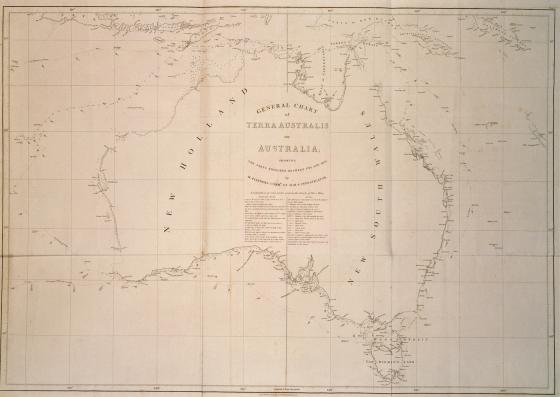
'General Chart of Terra Australis or Australia: showing the parts explored between 1798 and 1803 by Matthew Flinders Commander of H.M.S. Investigator' 1814
Matthew Flinders’ chart, published in 1814, was the first chart to use the name Australia, and it accompanied Flinders’ monumental publication, A Voyage to Terra Australis. The chart reflects surveys undertaken by Flinders from 1796 on the southern coast of New South Wales and northern coast of Van Diemen’s Land and on his partial circumnavigation of Australia between 1801 and 1803 on the Investigator.
Flinders was also the first to use the term ‘Australian’ in a place name, naming the Great Australian Bight on the chart.