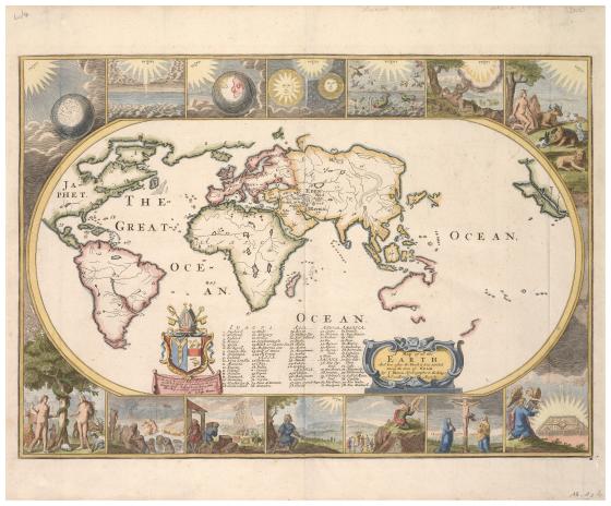
A map of all the Earth and how after the Flood it was divided among the sons of Noah 1671
Designed to be bound inside a Bible, Joseph Moxon’s map provides a fascinating glimpse into how maps were used to help readers visualise and comprehend text from the Bible in the 17th century. Moxon produced several different Bible maps, with this one illustrating the division of the earth between the sons of Noah following the Flood. The earth’s landmasses are labelled with the names of Noah’s descendants and numbered to correspond to contemporary place names. Despite the ancient subject matter, the map is current for its time, incorporating geographic information about the coastline of Australia obtained from Tasman’s voyages (1642–43 and 1644). Bordering the map are vignettes illustrating the Seven Days of Creation, and biblical scenes, including the Fall of Man, Moses receiving the Ten Commandments and Crucifixion of Christ.