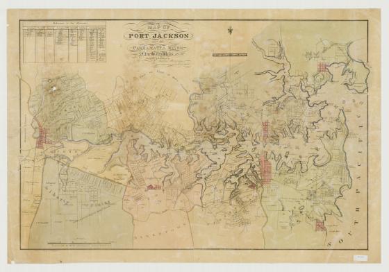
Map of Port Jackson and the Parramatta River, New South Wales ca. 1850
This map was produced around 1850 in Sydney by William Meadows Brownrigg, a surveyor and lithographic printer. It is noted at the bottom of the map that it was drawn on stone by William Henry Fernyhough who was a silhouette artist, lithographer and draughtsman.
By 1850, the Sydney settlement stretched across the Harbour to the north shore, identified as the town of St Leonards. Land ownership and settlement has moved northwards marked as the district of Willoughby. Owners such as Wolstonecraft [sic], Berry and Mossman [sic] have large pockets of land in this area. Across in the east, landowners names are a roll call of signficant characters of early Sydney: John Piper, Thomas Mitchell, William Wentworth, Alexander McLeay. Settlement runs along the length of the Parramatta road through districts such as Concord and Liberty Plains. The Windsor road, Pennant Hills road and Kissing Point road spread out from the Parramatta township. The Female Factory, the Female Orphan School and the gaol are indicated at Parramatta and the Marsden name continues to be associated with this area.