Collection Item

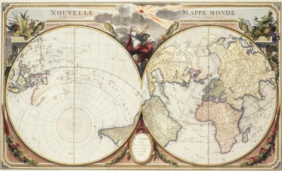
Nouvelle Mappe Monde dediee au progres de nos connoissances 1776
When we look at a sphere, we can only see approximately half of the object. Therefore, representing the entirety of the sphere-shaped earth on a sheet of paper requires drawing two hemispheres. There are countless ways the earth could be divided into hemispheres, but it was common in the 18th century to feature the old world in one (Africa, Asia and Europe) and the Americas in the other. This map takes a more unconventional approach, suggesting that the earth can be divided into a water hemisphere and a land hemisphere. A feature of this proposed division, which was developed in France, is that Paris is at the centre of the land hemisphere.