Collection Item

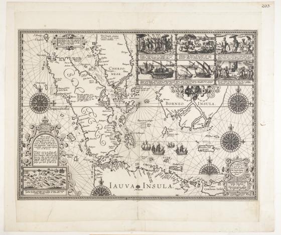
Nova tabula Insularum Iavæ, Sumatræ, 1598
Dutch nautical chart created to illustrate the voyage of the first Dutch fleet captained by Conelius de Houtman from 1595 to 1597. Chart focusses on southern Malaya, Sumatra, Java, southern Borneo and the islands east of Java through to Sumbawa. It is considered to be the first accurate detailed record of the north coast of Java created by Europeans and includes seven scenes depicting the experiences of the fleet.
Includes compass roses and rhumb lines. Scale "Hispancce leucæ 17 1/2 uni gradui competentia; Militaria Germanica, quroum 15. uni gradui respondent"
Call Number:
M2 471/1598/1
Published date:
1598