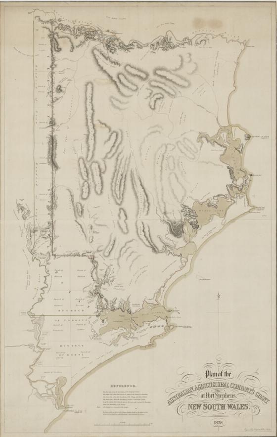
Plan of the Australian Agricultural Company's grant at Port Stephens 1828 [cartographic material] / engraved by J. Cross 18 Holborn London .
The AA Company was incorporated in Nov. 1824, to be granted one million acres for which 1s. 6d. was to be paid in addition to an annual quit rent. It is unclear who drafted the map engraved by Cross: possibly Henry Dangar or the Surveyor-General John Oxley, who suggested Port Stephens land as suitable for the AA, and was a shareholder paid by the company for advice and assistance.
Map showing land from Manning River down to Newcastle, Williams River to the sea, and mentions the Hundreds of Avon, Gord, Torrens and Morna. The adjoining Clergy and School Estate also shown.
Online images available via the State Library of NSW at: http://acms.sl.nsw.gov.au/album/albumView.aspx?itemID=949805&acmsid=0 ; Digital order number a5004001.
Mitchell Library copy at M Ser 4 000/1 A 3004/Map 23: Part of Macarthur Family - Papers, 1789 - 1930 [First Collection], A 3004.
Mitchell Library copy at Z/M4 811.23/1828/1B: shows roads and properties in colour, with ms. notes from 1830.