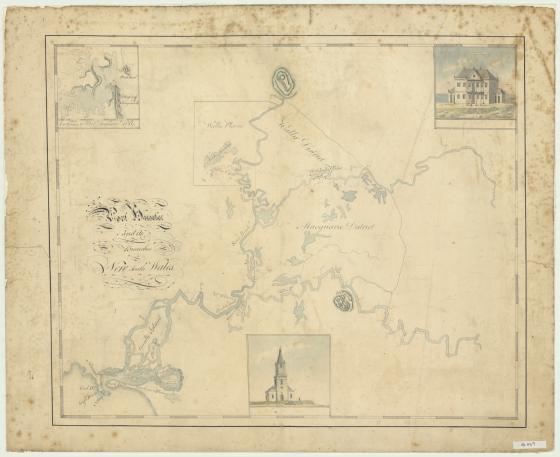
Port Hunter and its branches, New South Wales [cartographic material] 1819?
This 1819 manuscript map traces the Hunter River from Newcastle. It has been annotated in pencil, noting where there is good soil, fine grassland or swampy ground.
Governor Macquarie had journeyed to Newcastle in July of 1818 and explored the Hunter region, naming several landmarks. Macquarie notes in his journal, 'This is a very beautiful and Picturesque River, and has sufficient depth of Water in it as far as I have gone up it for a Vessel of 50 Tons Burthen, and the Land on its Banks being excellent, it is in every respect fit for establishing Settlements on.'
Three insets showing local buildings, one being Christ Church, Newcastle, an untitled building and one map entitled 'Entrance to Port Jackson, 1819'.