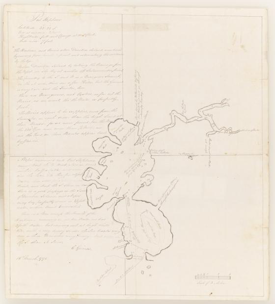
Port Stephens 1795
Grimes was appointed in 1790 as Deputy-Surveyor of roads, employed on Norfolk Island. He stayed on the Island for 4 years and was appointed head constable. In April 1794 he was posted to the mainland to assist the Surveyor-General, Augustus Alt. He was first stationed at the Hawkesbury River and then at Toongabbie.
In February 1795 he visited Port Stephens and surveyed the area for Lieutenant-Governor Paterson. Grimes reports that the Harbour and Rivers above Direction Island (now called Boondabah or Middle Island) were traced by rowing from point to point and estimating the distance by the eye. 'Below Direction Island, by taking the bearings from the vessel, as she lay at anchor off Salamander Point the country to the South and West is a mangrove swamp, on the north side there are a few hills, but the ground is very bad and the timber, low. There are mangroves and oysters, as far up the Rivers as we went, tho' the water is perfectly fresh.'
Grimes has also included depth soundings, information regarding the bar across the entrance to the harbour and notes about locations of fresh water.