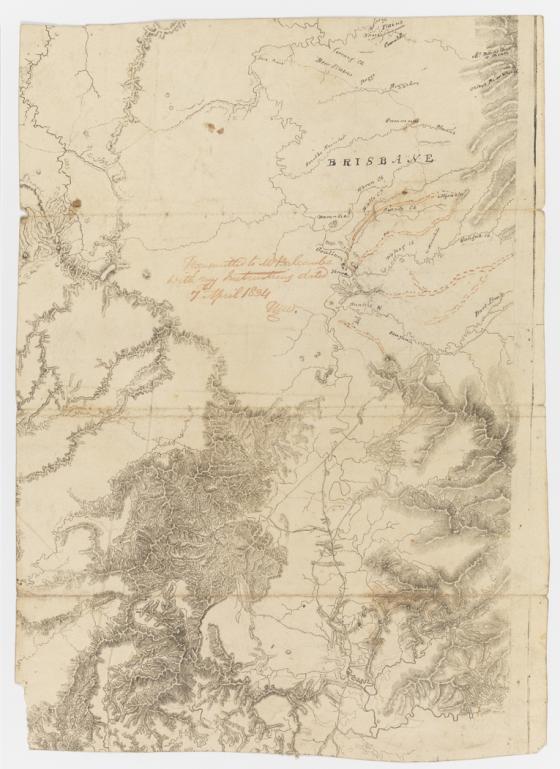
[Portion of Map of the Colony of New South Wales transmitted to Thomas Balcombe by Major Mitchell on 7 April 1834] [cartographic material] / Thomas Mitchell. 7 April 1834.
This map is an important early proof of portion of Major Mitchell's map, with name places and outlines of mountains added in Mitchell's hand. Same proof on verso, with 20% more shown at top, but no holograph notes. The area shown entails the Central Tablelands and Goulburn and Hunter Rivers, first surveyed on Mitchell's instructions by John Rogers from September 1829. Compared with the final engraving, this map shows that only some of the mountains marked in red by Mitchell [Jerry's Plains Range, Mt. Wambo?] were in fact added. Thomas Tyrwhitt Balcombe was son of William Balcombe of the St. Helena notoriety, who was the first Colonial Treasurer. Balcombe was a draftsman and later a field surveyor in the Surveyor General's department. A painter, lithographer and sculptor, he shot himself at his home, Napoleon Cottage in Paddington, in 1861.