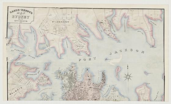
Sands & Kenny's map of Sydney and its environs 1858
Published by Sands and Kenny, the publishers of numerous post office directories, business direcories and street maps, this map was produced during a time of strong growth in the Australian colonies as immigrants from all over the world were arriving in port during the gold rush era. No longer a struggling settlement, this map depicts a growing city.
Roads, railways, public buildings and reserves are identified. On Macquarie street there is the Legislative Council Chamber, the hospital and Government Printing Office. The Australian Subscription Library is located at the corner of Macquarie and Bent streets. Numerous churches and banks are identified.
The wharves alongside Darling Harbour have the names of their company owners and at the southern end of town are the Benevolent Asylum, the Devonshire street burial grounds and breweries, such as the Albion and Kent breweries in Surrey Hills and Chippendale.