What are the natural and human features of the Shoalhaven River area?
This is the student activity 1 of 7 of the Factors that shape places: Shoalhaven river learning activity.
What are the natural and human features of the Shoalhaven River area?
Climate
Use Source 2 to identify the average rainfall, maximum and minimum temperatures and describe the climate of the Shoalhaven River area.
Source 2: Bureau of Meteorology Climate map
Natural and human features
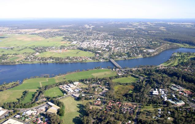
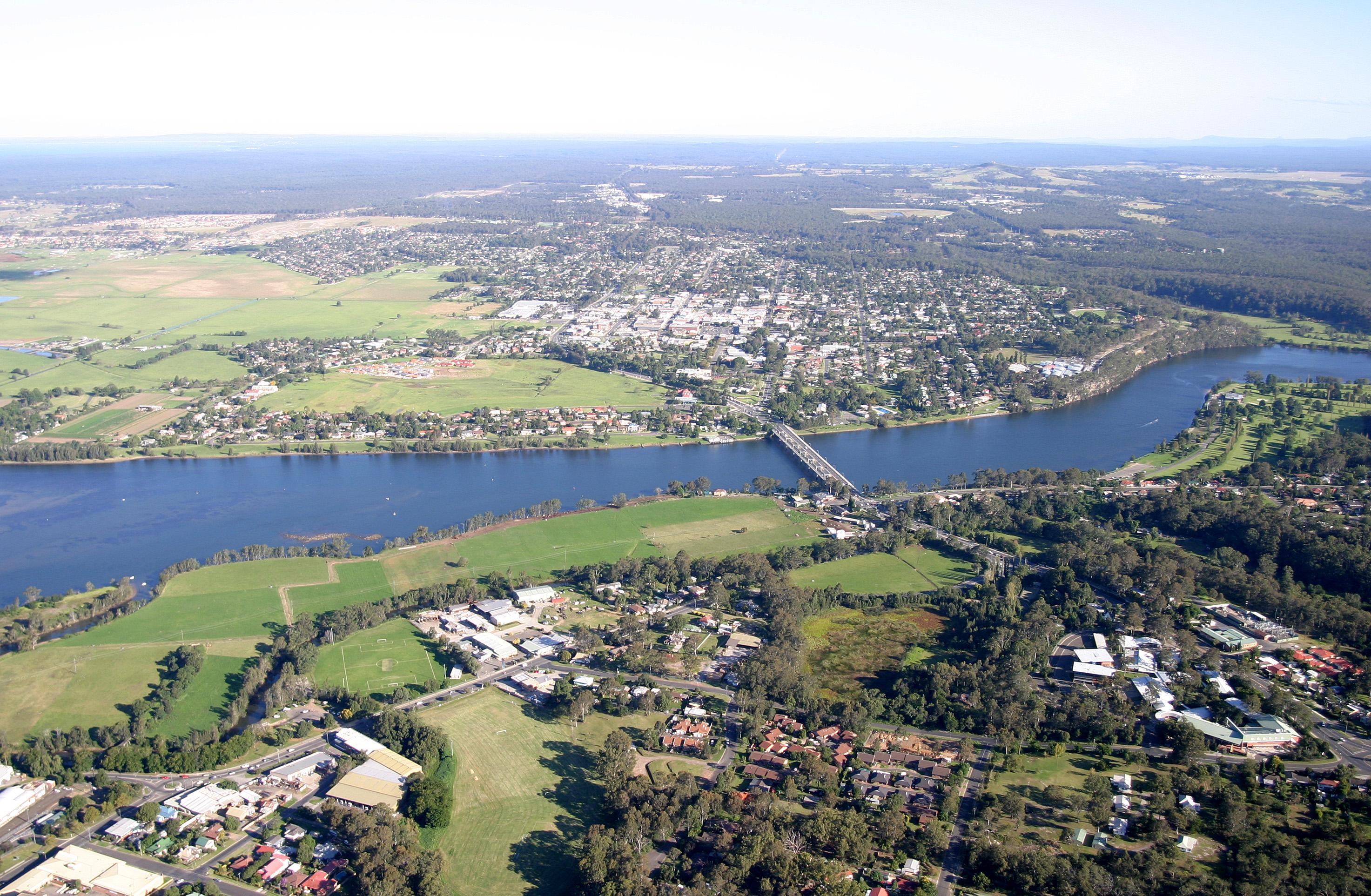
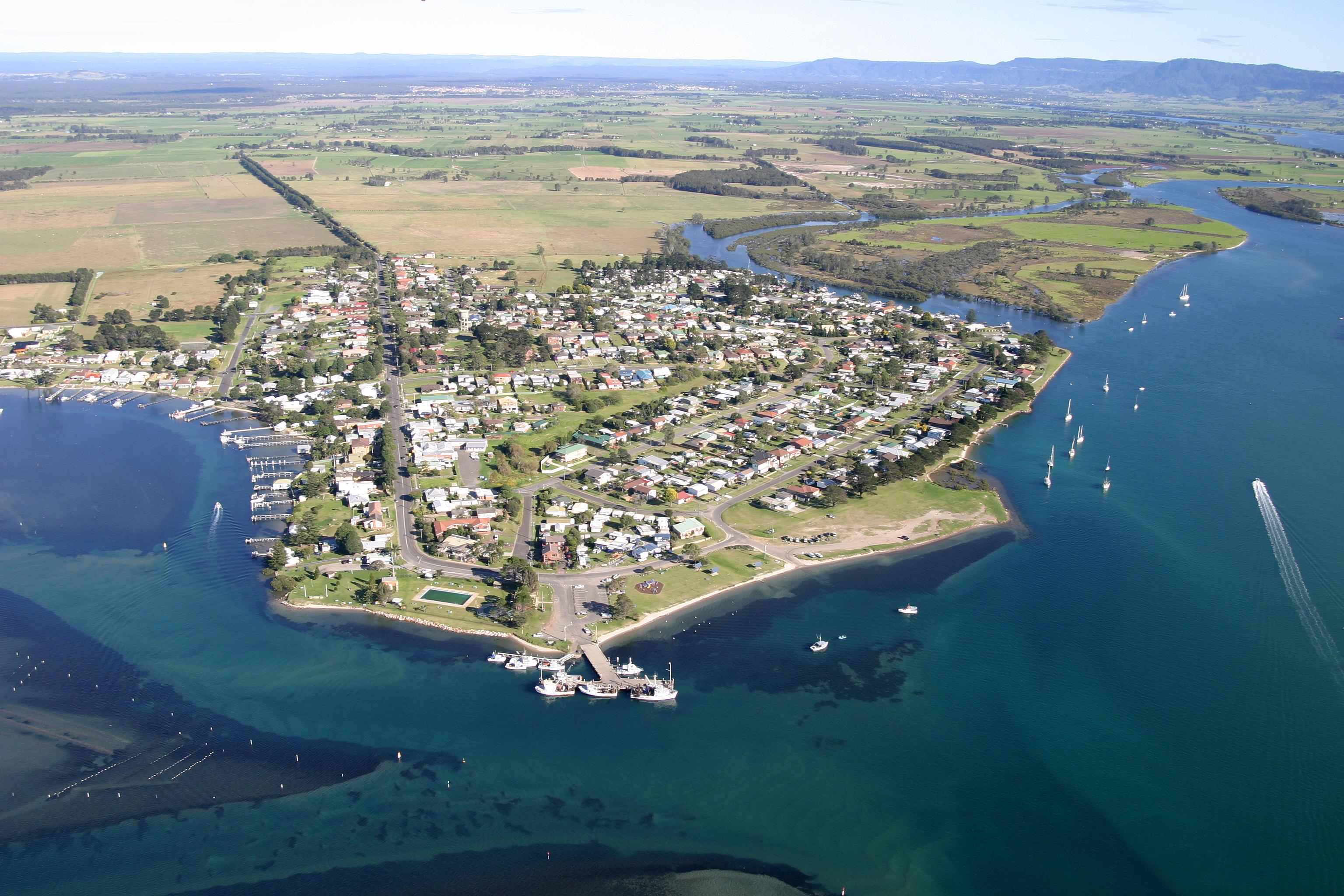
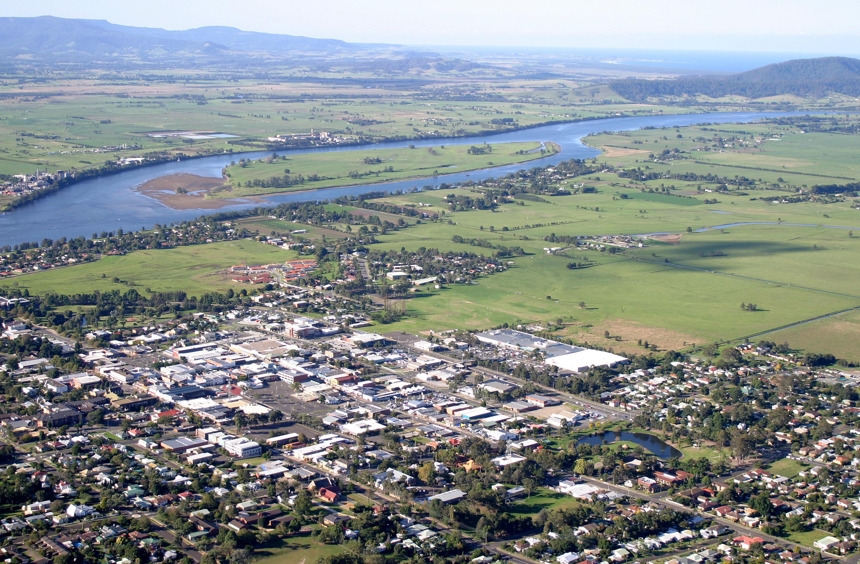
View the Shoalhaven River images in Sources 3 and 4 and discuss how to identify the natural and human features of the Shoalhaven River area using the word banks as a guide.
Photo sketch
Using the large image online in the download resource, draw a sketch map of Shoalhaven River area in Source 5. Label the natural features, focusing on landforms and the human features, including land use.
Questions for discussion
Natural features
- What landforms do you see? For example, beaches, flood plains, hills, rivers, valleys.
- What other natural features do you see?
- What natural vegetation do you see? Where is the vegetation in relation to the landforms?
Human features
- What human features do you see?
- How is the land being used in each of the images?
- What is the purpose behind this use?
- Discuss possible reasons for the location of the urban areas and the farming areas.
Natural features word bank:
beach, escarpment, estuary, forest, higher flood-plain, hill, low-lying flood plain, mountain, mountain range, ocean, river
Human features word bank:
business centre, bridge, car park, farmland, fishing jetty, housing, industrial area, moorings, oval, oyster lease, residential, road, shopping centre, wharf