Acquiring geographical information
Topic: People Live in Places
This is the student activity 1 of 3 of the Locating places: pictorial maps learning activity.
Task No. 1
Pictorial representations
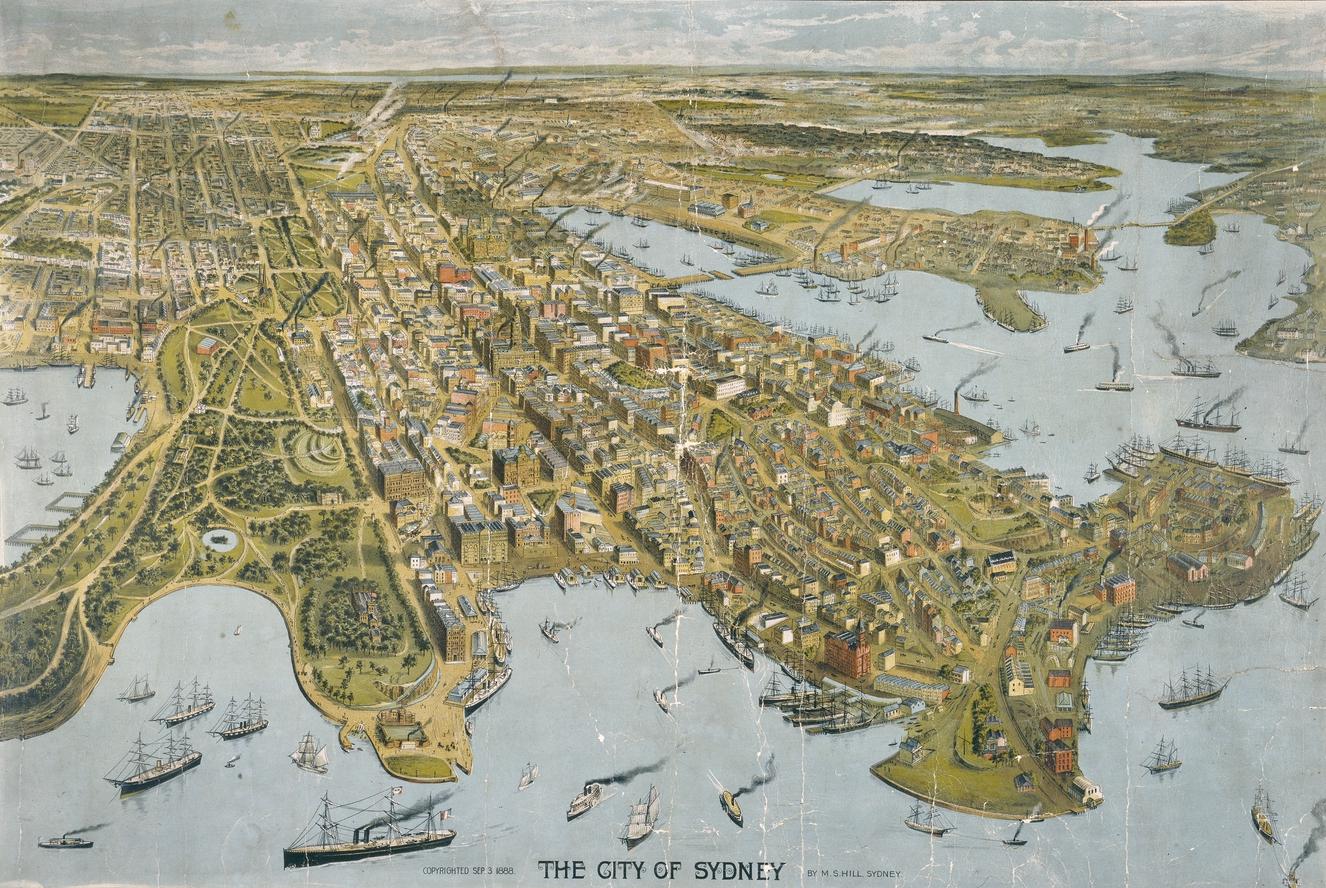
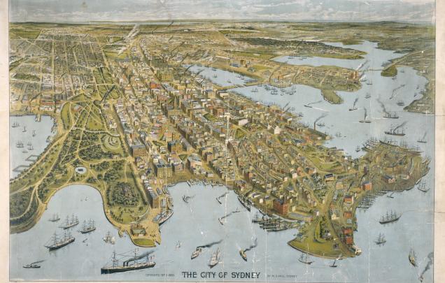
The City of Sydney
View sourcse 2 and 3 and use the zoomable map for source 2 to explore its details.
Questions:
Observe
- Are there bridges? Where?
- is there parkland? Where?
- Where is the tallest building?
- What is the water transport?
- What is the land transport?
Interpret
- Where would people work?
- Where would people play?
- Where would you walk?
- Where would you drive?
- Where would you catch a ferry?
- What would you want to visit? Why?
Follow the link to Source 3: The heart of Sydney in the year 1938 by Robert Emerson Curtis
Task No. 2
What is a map?
After your teacher has read 'My Map Book' to the calss, look at all the maps shown in the book. Use the word bank below to describe where things are on each of the maps.
Positional language: across, around, over, past, through, under, beside, behind, between, near, far, above, below.