Places are similar and different: climate of places
Key inquiry question #1
How and why are places similar and different?
Content Summary
Climate of places
Students:
- investigate the climates of different places, for example: (ACHGK017)
- discussion of how weather contributes to climate
- comparison of climates in different places
Background notes for teachers
The focus on the activities listed is on the climate of different places. The activities can be expanded to include research into the settlement patterns and demographics of the places and the lives of the people who live there as described in the topic: Similarities and differences between places.
There is a strong focus on using geographical tools in this unit: maps, data tables, column graphs, simple statistics, satellite images, photographs, illustrations and web tools.
Sources 1 and 7 provide examples of field sketches. Before photography was available, field sketches and maps were the main way of recording and communicating observations. When comparing each sketch to the related photograph in the sources it can be seen that the sketches are accurate visual representations. There are numerous colonial sketchbooks held in the collection of the State Library of New South Wales.
Field sketches and line drawings continue to be an effective way of recording observations during geography fieldwork.
Student Activities
Australia’s Tropical North
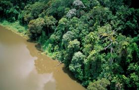
Students view two source photos. The students imagine visiting the Barron River area and travelling by boat to the mountains in the sketch as the artist did. Students describe what they would see around them and the type of weather they may experience (temperature, humidity).

Tropical, desert and temperate places
Ona a map of Australia students plot the capital cities, Barron River, Cairns, Bourke, Enngonia, Swansea (Tas) and Freycinet Peninsula and mark in key data

Plotting climate data
Students extract climate data from various websites and use it to complete tables on rainfall and average temperatures in specific regions.

Relocating advice
What would it be like to relocate to Darwin or Cairns or Enngonia or Oyster Bay?

Activity notes for teachers
Engagement - students view Sources 1 and 2. Ask the students to imagine visiting the Barron River area and travelling by boat to the mountains in the sketch as the artist did. Students describe what they would see around them adn the type of weather they may experience (temperature, humidity)
Use Google Earth (click on the Earth icon in Google maps) or an atlas to locate the Barron River. Students compare the Barron River to where they live.
On a map of Australia, students plot the capital cities, as well as Barron River, Cairns, Bourke, Enngonia, Swansea (Tasmania) and Freycinet Peninsula. Students mark in the key climate zones.
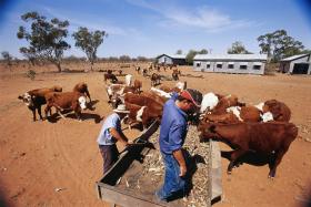
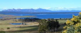
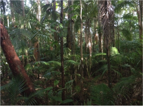
b. Students analyse Sources 1 to 8 and write their observations and inferences of each place in a comparison table found in the downloadable resource.
a. Explain that climate is the average weather pattern in a place over many years. Demonstrate how to interpret the Bureau of Meteorology Climate Data Online site. Use the Cairns data as an example.
b. Students extract climate data for two of the places listed below and complete the average temperature and rainfall tables from the downloadable resource.
- Barron River, QLD (Cairns)
- Darwin, NT
- Enngonia, NSW (Bourke)
- Oyster Bay, Tasmania (Swansea)
c. As a demonstration, use the plotting tool to show graphs for the data and comparison graphs for two places. Students create a column graph to represent their average rainfall and temperature data.
Have students imagine that they have to move house to one of the two places they investigated. They compose a text explaining the reasons why they have chosen one place over the other, making reference to the data in their comparison tables they have constructed.
Additionally, students create a mock travel advice blog post or webpage advising prospective residents on what to expect about the climate and features of one of the two places they investigated. They include advice on what weather to expect throughout the year, key climate data and what clothes and equipment are needed for the various seasons.
Resources
Picture books
Why I Love Australia by Bronwyn Bancroft
My Home in Broome by Tamzyne Richardson and Bronwyn Houston with friends
A Year on Our Farm by Penny Matthews and Andrew McLean
Where the Forest Meets the Sea by Jeannie Baker
The Story of Rosie Dock by Jeannie Baker
Videos
The Daintree, Where Forest and Reef Meet
A Haven in the Harsh Desert Heat
Web resources
Australian climates – relationship between climate and weather
NSW Syllabus for the Australian Curriculum Geography K–6
A student:
- GE2-1 examines features and characteristics of places and environments
- GE2-4 acquires and communicates geographical information using geographical tools for inquiry
Acquiring geographical information
- develop geographical questions to investigate (ACHGS019, ACHGS026)
- collect and record relevant geographical data and information, for example, by observing, by interviewing, conducting surveys, or using maps, visual representations, the media or the internet (ACHGS020, ACHGS027
Processing geographical information
- represent data by constructing tables, graphs and maps (ACHGS021, ACHGS028)
- represent information by constructing large-scale maps that conform to cartographic conventions, using spatial technologies as appropriate (ACHGS022, ACHGS029)
- interpret geographical data to identify distributions and patterns and draw conclusions (ACHGS023, ACHGS030)
Communicating geographical information
- present findings in a range of communication forms, for example, written, oral, digital, graphic, tabular and visual, and use geographical terminology (ACHGS024, ACHGS031)
- reflect on their learning to propose individual action in response to a contemporary geographical challenge and identify the expected effects of the proposal (ACHGS025, ACHGS032)
- Place: the significance of places and what they are like (ie. natural and human features and characteristics of different places and their similarities and differences; how people’s perceptions about places influence their responses and actions to protect them).
- Space: the significance of location and spatial distribution, and ways people organise and manage spaces that we live in (ie. settlement patterns within Australia, neighbouring countries and other countries).
- Environment: the significance of the environment in human life, and the important interrelationships between humans and the environment (ie.how climate and environment influence settlement patterns; interconnections between people and environments; differing ways people can use environments sustainably).
- Interconnection: no object of geographical study can be viewed in isolation (ie.interconnections between people, places and environments; influence of people’s values on the management and protection of places and environments and the custodial responsibilities of Aboriginal and Torres Strait Islander Peoples).
- Scale: the way that geographical phenomena and problems can be examined at different spatial levels (ie. types of settlement across a range of scales; the influence of climate across a range of scales).
- Sustainability: the capacity of the environment to continue to support our lives and the lives of other living creatures into the future (ie.ways in which people, including Aboriginal and Torres Strait Islander Peoples, use and protect natural resources; differing views about environmental sustainability; sustainable management of waste).
Learning Across the Curriculum
- Information and communication technology capability
- Critical and creative thinking
- Literacy
- Numeracy
- Difference and diversity
- Work and enterprise