Map Rooms
Located on First floor in the Mitchell Library building, explore five centuries of cartography from around the world and discover a space where you can carry out quiet research.
Thank you to our donors
The Map Rooms have been made possible by the Library Foundation, thanks to the generosity of private donors.
What you'll see in the Map Rooms
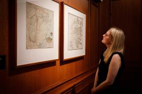
Located on First floor in the Mitchell Library building, these two rooms house important maps, globes and navigation instruments from the Library’s maps collection – arguably the most significant in Australia.
Highlights include:
- Gerard Van Keulen's rare atlas from 1717, De nieuwe groote lichtende zee-fakkel
- a beautiful hand-coloured copy of the 19 counties map produced by Sir Thomas Mitchell in 1834 – the 19 counties were the legal boundaries of the colony up to that date
- a silver punchbowl in the shape of a globe, commissioned by botanist Sir Joseph Banks in 1772, with Antarctica sitting on its lid
- the 1940 Tindale map showing the distribution of Aboriginal language and nation groups in NSW
- a selection of early maps showing the gradual colonisation and expansion of Sydney from a penal settlement to a bustling metropolis.
Visiting the Map Rooms
The Map Rooms provide a quiet space if you want to carry out independent research. Tables and power outlets allow you to work on laptop computers and other devices.
The rooms are also available as a venue to hire for a function (conditions apply).
View items on display