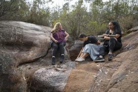
I’m standing on the banks of Wianamatta, or South Creek, with Darug knowledge-holders, artists and educators Jasmine Seymour, Leanne Watson and Rhiannon Wright. Together with my colleagues Avryl Whitnall, Joy Lai, and videographer Bill Code, we’re here filming for an exhibition we’re putting together on Darug stories of Dyarubbin, the Hawkesbury River.
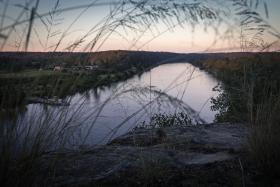
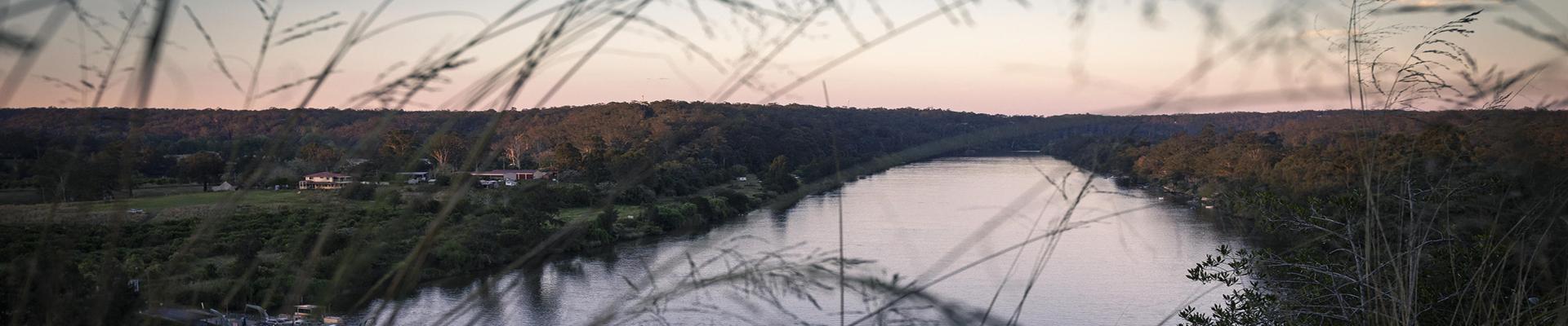
We raise our voices to talk to one another against the noisy traffic heading in and out of Windsor on the Fitzroy Bridge. Leanne tells us that Wianamatta was an important pathway and resource for Darug people, running north some 70 km from Oran Park through some of Sydney’s driest, hottest Country before eventually joining with Dyarubbin. I try to follow its long line with my eyes but it curves out of view almost immediately, the closest bend thickly obscured by shrubs and weeds.
Behind us is the old toll house built at Green Hills (later renamed Windsor) by Andrew Thompson, one of the early colony’s most celebrated figures. A convict who became a wealthy landowner, chief constable and magistrate, Thompson is remembered as something of a hero for saving settlers from the floods of 1806 and 1809. He died a year later from complications of a respiratory infection he had sustained in the second flood.
Governor Lachlan Macquarie had these deeds inscribed on Thompson’s tombstone and named Thompson Square, in the centre of Windsor, in his honour. When the story of Thompson as the exemplary emancipist is told, even today, one detail is usually omitted.
Thompson led a party of settlers that massacred Darug people at a camp at Yarramundi, about 20 km west of Windsor, in 1805. In this reprisal for the killing of three settlers, seven, eight, or possibly more Darug ancestors were killed, including leader and cross-cultural spokesman Yaragowhy.
This well-documented event is not so much a secret as a rarely mentioned blight on the shining narrative of Thompson’s life and legacy. That he would have overseen, facilitated or been aware of other violent crimes against Darug people as chief constable and magistrate further complicates how he might be remembered. Jasmine, Leanne and Rhiannon believe the failure to confront the darkest aspects of colonial history in this region contributes to the continued erasure of Darug people who have lived along this part of Dyarubbin for millennia.
Bulyayorang is the name for the land over which Windsor was built. On a high point above the river — where Thompson Square is now — was a corroboree ground.
The information publicly available about Windsor makes little mention of this history, but gives ample information about the site’s colonial foundations, promoting the heritage value of its Georgian buildings, and even recounting the time when it was known as Bell Post Square and hosted convict floggings. That a special place for the Darug people was co-opted for this purpose is unquestioned. Heritage sites across the Hawkesbury River region focus almost exclusively on colonial history, Leanne tells us, and don’t reflect Darug people’s history or culture.
I’m reminded of an 1809 painting of the area by surveyor George William Evans — The Settlement on the Green Hills, Hawksburgh River N.S.Wales — which depicts the small but prosperous-looking settlement that would come to be known as Windsor. The watercolour painting has deteriorated over time: its once-green hills have darkened in some places and faded in others; the blue river and sky are now grey. The muted palette lends an even greater sense of calm in the colony than the painting originally intended. It belies the unease that must have been felt in the region at the time of brutal frontier wars. This is Evans’ reflection of the settlement as it would like to see itself, of course, a vision legitimised by denying Aboriginal sovereignty and custodianship of the very same place.
It’s well known that Dyarubbin’s fertile flood plains became prized agricultural land, the ‘food bowl’ that was crucial to the early colony’s survival. But taking land along the river for farming and settlement came at a great cost, increasingly cutting Darug people off from their most vital resource.
Every year when the maize ripened, Darug people would come and take the produce of their Country. Some settlers shared it with them; others shot at them. Warfare broke out when Darug warriors — men and women — fought to defend not only their lands and livelihoods, but also their culture, spirituality and sense of being. This identity was — and still is — intrinsically connected to the river.
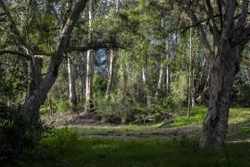
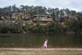
Following the river, we drive about 15 km north-east to Cattai. Even today, pockets remain of the plentiful resources traditionally used by Darug people. Jasmine and Leanne collect spinach-like Warrigal greens, native raspberry and wombat berry vine as well as sandpaper fig, which was used to sharpen tools, and native geranium, a poultice for arthritis.
The site has even greater significance, as Jasmine and Leanne believe Cattai marks the beginning of an important part of Darug lore. It’s here that the landscape changes from alluvial river flats to sandstone Country. Rock engravings on the biggest bends of the river tell the story of the Great Eel, the creation ancestor spirit.
We heard that some of the engravings have been destroyed, and we could see that the places where traditional foods and resources can be found are rife with invasive weeds and rubbish, with tyre marks churning up the earth. Jasmine and Leanne call this wirri ngura: bad Country, sick Country. The resilience of the plants is remarkable.
Further north-east, we visit healthy Country at Marramarra National Park, where a rock art cave is protected by a steel barrier. We spend almost all our time here looking up, our eyes running over the beautiful ochre paintings of echidnas, turtles, tiger quolls and ancestor beings. The paintings suggest the cave was a significant site.
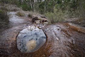
On the lip of a waterhole above the cave — one of several — are axe grinding grooves. Jasmine, Leanne and Rhiannon believe the circular motif repeated on the cave’s interior walls, joined by one continuous line, may represent the surrounding waterholes — plentiful across the whole area — which then connect with creeks lined with yet more special sites.
This abundance and interconnectedness is reflected in the name of nearby Maroota, which means ‘the place of many springs’. Keeping the waterholes and creeks healthy and flowing in such hot and dry Country would have been critical for the ancestors taking care of this place. Today, farming and sandmining upstream threaten this complex network of waterways.
In 2017 historian Grace Karskens came across a list of Aboriginal placenames along Dyarubbin compiled by Reverend John McGarvie, a Presbyterian minister, in 1829. Titled ‘Native Names of Places on the Hawkesbury’, this manuscript at the State Library of NSW lists six pages of placenames in the order of their location along the river. The list became the basis of the project ‘The Real Secret River, Dyarubbin’ — conceived in collaboration with Jasmine, Leanne, Rhiannon and Darug woman Erin Wilkins — which won the Library’s Coral Thomas Fellowship for 2018–19.
As most of the placenames on McGarvie’s list had been lost, as Aboriginal languages were systematically diminished over time, one of the project’s aims is to map and return the names to their river locations. It is hoped that this will encourage wider usage and understanding of their meanings. Concurrent exhibitions at the Library and at Hawkesbury Regional Gallery will be among the ways these placenames and their stories are shared with Aboriginal people and brought to diverse audiences.
On our next weekend of filming we travel to a place of enormous spiritual significance for Darug people: one of the resting sites of Gurangatty, the Great Eel ancestor creation spirit, in one of the deepest parts of Dyarubbin. Even with the cicadas’ endless droning, it’s peaceful sitting on a ridge high above the river. Jasmine, Leanne, Rhiannon and Erin tell us that the water swirling on the water’s surface is symbolic of the Great Eel, which is connected to water, whirlpools and flood power.
Further downstream is Dorumbolooa, which means ‘zone of the rainbow’ or ‘path of the rainbow’. Further still, at Wowawme, another placename on McGarvie’s list, Gurangatty is said to keep watch from a steep rock shelf. (‘Waway’ means ‘serpent spirit’ and mii is ‘eye’ according to Professor Karskens and linguist Dr Jim Wafer, who has been working on the Real Secret River, Dyarubbin project). Jasmine says Wowawme connects the Great Eel to stories of the Rainbow Serpent across the continent.
‘We are still here. This always was, this always is , and this always will be Darug Country.’
Our last day of filming is at Shaws Creek Aboriginal Place in Yellomundee Regional Park. An important meeting, fishing and camping place, the site is a traditional river pathway through to the Blue Mountains. We’ve arrived at the same time as an Aboriginal dance troupe, which is also filming here.
Erin tells us that Aboriginal people from all over Sydney still gather here to socialise and continue the cultural practices of firestick farming, cultural burning and dance. When we ask her what she’d like people to take away from the Dyarubbin exhibition, she looks at the camera and says: ‘We are still here. This always was, this always is , and this always will be Darug Country.’ She’s right, and there’s no better place, and no better way, to say it.
Marika Duczynski (Gamilaraay), Indigenous Engagement project officer
This story appears in Openbook autumn 2021.