Geological histories of Australia have many points of origin. Geologists might situate their accounts of formation in the three-and-a-half-billion-year-old Pilbara Craton, some of the oldest rocks on the surface of the Earth. They might ground their studies in the present-day Flinders Ranges, site of the half-abillion- year-old Ediacara fossils, the oldest recorded complex life on the planet. Earth scientists, geographers, and environmental historians alike have been drawn to the seafloor just south of Tasmania, where a segment of oceanic crust charts the final stages of the breakup of the ancient supercontinent Gondwanaland. These rocks mark the beginning of Australia’s 50-million-year continental isolation.
There are more recent starting points too. One geological history of Australia begins on 26 May 1839. On this day, on the far eastern edge of the huge sandstone bowl of the Sydney Basin, William Clarke stepped off the ship, Roxburgh Castle, at Dawes Point and onto what he would come to call ‘a new earth for geology’. Clarke’s appearance in sandstone country tempts us to enter geological history backwards, so to speak. Through this moment we can move from the intellectual contexts of natural theology and British geology into a colonial world shaped by colliding civilisations. Then, even further back into the deep time of the antipodean landscape itself. This path might help us, as the writer Robert Macfarlane suggests in his extraordinary book Underland, confront our troubled present with ‘older, slower stories’.
Clarke arrived in New South Wales in 1839 as an Anglican minister, but he is best remembered as a geological thinker. Generations of scientists and now, historians of science, have recognised Clarke as Australia’s ‘first’ geologist. It is easy to read such declarations as a form of settler myth-making, but they hold a grain of truth. There were many First Nations knowledge-makers, then settler surveyors and savants whose work Clarke repurposed and whose place in sandstone country he took up, but none who truly thought about the world geologically.
Born in Suffolk in 1798, Clarke first learned to think in this way at Jesus College at the University of Cambridge where, in the 1820s, he took classes with the Reverend Adam Sedgwick, Woodwardian professor of geology. For Sedgwick, as for Clarke, there was a divine truth — a natural theology — in the expanding geological horizons of the nineteenth century. Clarke forged a strong connection with Sedgwick, one of the dominant figures of early nineteenthcentury British earth science, but he also conducted fieldwork nearby across the sinking, sponging, rising, everchanging, increasingly drained fens.
At Cambridge, it was not God’s word that motivated Clarke but nature’s book. As a student, Clarke was more taken with mineralogy and geology than he was with his holy orders. Soon after, as a curate in Dorset, he immersed himself in the local Jurassic fossils and published fifty papers in the Proceedings of the Geological Society and the Magazine of Natural History.
After arriving in New South Wales Clarke was appointed headmaster of The King’s School in Parramatta, with responsibility for the parishes of Castle Hill and Dural. In the course of his pastoral duties, Clarke ranged widely over the Cumberland Plain, observing landscapes and collecting rocks and fossils from the Hornsby Plateau in the north all the way to the headwaters of the Nepean River in the south.
In December 1839 the budding American geologist James Dana arrived in Sydney with the United States Exploring Expedition and over the dry heat of a Sydney summer the two newcomers bonded. On New Year’s Day, Clarke rode south to meet Dana in Wollongong, where they spent a fortnight in the valleys of the Illawarra. During their exploration they attended a Tharawal corroboree, noted the presence of substantial coal seams, and collected specimens of fossils, minerals and plants. According to one of Clarke’s biographers, Ann Moyal, this convivial experience forged his scholarly investment in and commitment to the Australian landscape. During the 1840s Clarke embarked on several expeditions designed to chart the extent of the Sydney and Hawkesbury sandstones, the coal deposits below them, and the neighbouring formations in the Illawarra and the Hunter. Across Eora, Darug, Kuring-gai, Gundungurra, Tharawal, Awabakal, Worimi, and Wanaruah Country, Clarke added depth to colonial topographies and gathered information about local features and natural phenomena. These expeditions revealed — to settlers at least — the fundamental geological structure of the Sydney Basin.
I like to think that during this period Clarke became a medium of the earth. Over the course of his career in New South Wales he absorbed not just the facts and features of the physical world but the accumulated environmental wisdom of a cast of local informants, including many First Nations people. In Awabakal country Clarke wrote a composite geohistory of Kurrur-Kurran, a forest of fossilised wood submerged in Lake Macquarie. His reports identified how these fossilised trees related to local beds of sandstone and coal, but they also recorded the Awabakal man Biraban and the missionary Lancelot Threlkeld’s account of how the fossils were scattered when ‘a large rock fell from the heavens’ and killed a group of people who had gathered at the command of a huge goanna. Channelling both Biraban’s sacred history and his own natural theology, Clarke described Kurrur-Kurran as ‘a singular picture of past and present.’
By absorbing local knowledge and putting it into global circulation, colonial geologists became world makers. As the nineteenth century wound on, geology became what the British historian James Secord calls the ‘ultimate cosmopolitan science.’ Geologists like Clarke reimagined and refashioned their worlds and through study and publication, turned New South Wales into an extractive landscape.
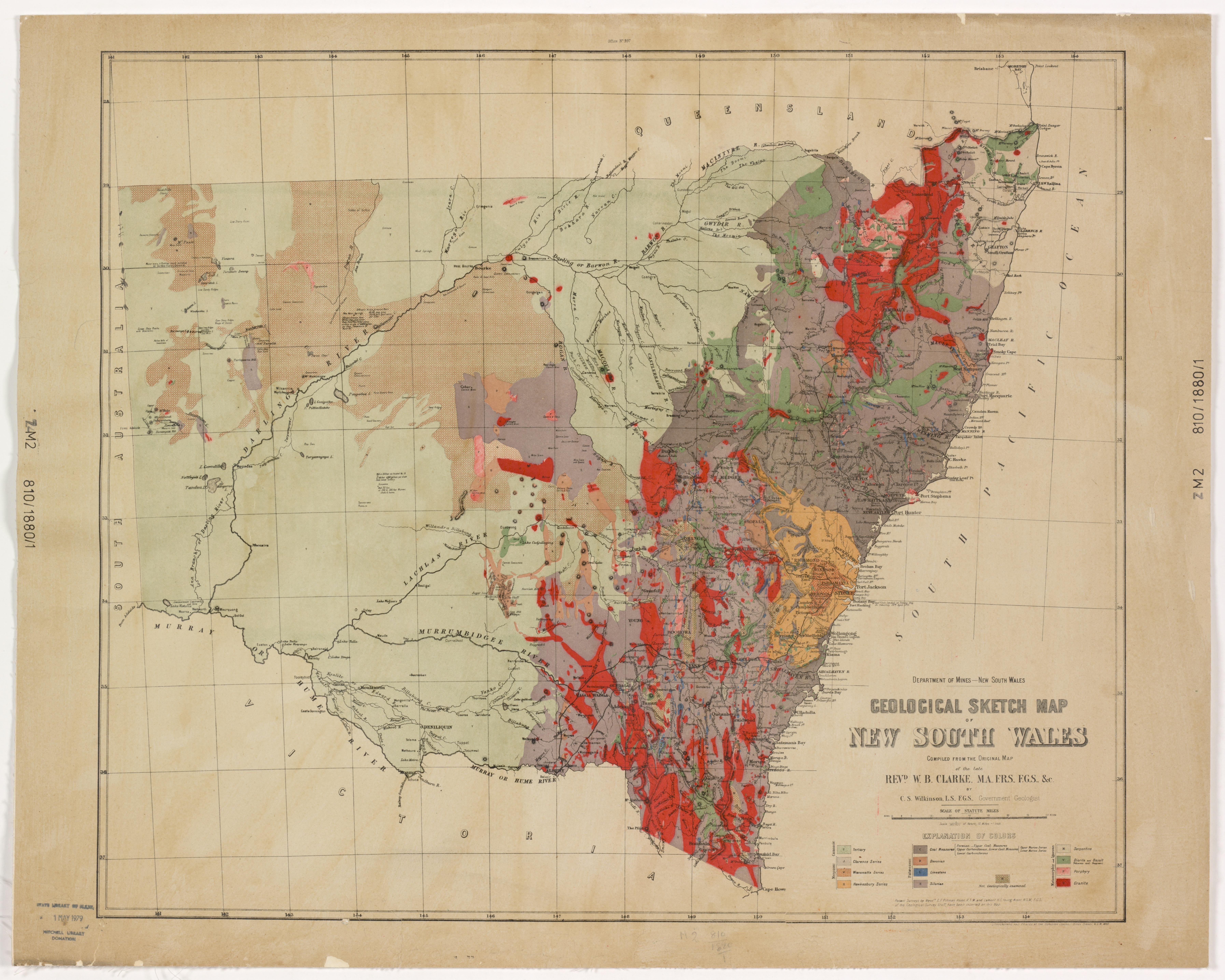
In his influential booklets, lectures and newspaper articles, Clarke encouraged prospectors to spread across New South Wales and reshape ecologies through mining. Diggers pored over his texts to identify promising locales and they relied on his advice to decide which goldfields to return to. Clarke’s pronouncements were based on extensive fieldwork across NSW, but it’s notable that he made them from Sydney. Sandstone country, through this process, was imbued with new authority. Already the centre of colonial governance, capital and trade, Clarke’s work in the 1840s and 1850s made it an entrepot of ideas about the earth as well.
Clarke might have initially defined sandstone country in a physical and geopolitical sense, but I think this place also shaped the settler geological tradition. Settler earth science had a kind of multi-directional application: at one end it was peculiarly geared toward environmental transformation, extraction and exploitation but at the other end it absorbed what we might think of as First Nations geohistory. A sense of awe and wonder at these different forms of geology courses through Clarke’s writing about sandstone country. Dana, who became Professor of Natural History and Geology at Yale University from 1850, continued to teach using illustrations of the Sydney Basin until his retirement in the 1890s.
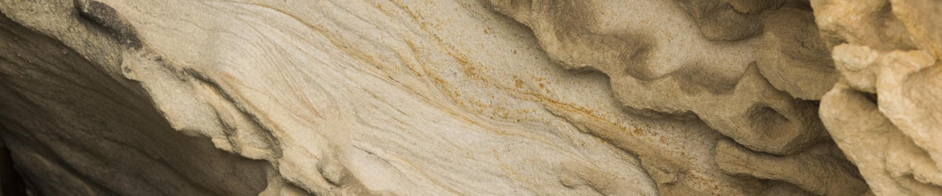
There is a stunning material resonance here between ideas and objects. Sandstone is a sedimentary rock, made up of weathered particles of quartz and feldspar that become fused together under pressure. It is both easy to work and remarkably strong. Before the settler invasion, the First Nations of the Sydney Basin used it as a durable canvas. After invasion it became a robust and beautiful building material, appreciated by engineers and masons for its structural qualities and its plasticity, well before there was even enough mortar to bind its blocks together.
Untreated, however, sandstone decays quickly. It bears the mark of other times in impurities, ripples, and stains, seen in the great Argyle Cut in The Rocks, where we can trace the flow of ancient glacial melt. Like settler geology, sandstone in the form that we know it in is a stable object. But it’s also a rock made of other rocks, in the midst of its own transformation back into particles of sand.
I’m an environmental historian but I have come to understand sandstone country by studying geologists, who share my obsession with time and place. I have learned that the Sydney Basin ranks among the crucial sites in the history of geology. This place is like the Auvergne, the Scottish Highlands, the Appalachian chain, or Gondwana in central India. Some of these sites influenced high theorising about the earth but others exemplified how intellectual projects became entwined with imperialism and colonialism. For me, and no doubt for Clarke, these latter factors, which ultimately relate to energy and its extraction, made the Sydney Basin highly significant.
As any colonial geologist would tell us, sandstone country is often coal country. Coal put the nineteenth-century world into motion and is the energy source that sent us hurtling into climate crisis. Starting the geological history of Australia with Clarke’s step over the threshold in 1839 — with his movement from one earth to another — focuses us on the unavoidable geopolitics of dispossession and damage. Through Clarke’s story and through my own study of sandstone country I have learned that any impulse to seek refuge in the poetics of deep time must reckon with these facts. Otherwise, we won’t be reimagining our troubled present at all, but recasting it.
Jarrod Hore was the David Scott Mitchell Fellow in 2020 and is a historian of environments, geologies and photographies. He is currently investigating the early stirrings of continental drift theory in colonial geological surveys, as part of a team working on a new history of Gondwanaland. His first book, Visions of Nature: How Landscape Photography Shaped Settler Colonialism, will be published in 2022.
This story appears in Openbook summer 2021.
Related Stories


Reimagining the Pacific
While the Pacific has loomed large in Australia’s history, there is a riddle at the heart of our relationship with the region.

The crime files
A true crime writer shows how she uses the archives to reveal histories that rarely come to light.
