Macquarie’s crossing
Macquarie's crossing
Blaxland, Wentworth and Lawson’s journey across the Blue Mountains sparked further and rapid exploration. On their return Governor Macquarie quickly sent his assistant Surveyor-General, George William Evans (1775-1852), to investigate building a road over the mountains.
Evans retraced the explorers' trail in November 1813, surveyed the route, pushed on into the grassy plains beyond the mountains and discovered the Macquarie and Lachlan Rivers. Macquarie then commissioned William Cox to build the road, completing the task in less than six months with a team of convict workers.
Eager to see the new territory for himself, Macquarie set out to inspect the road and the land beyond the mountains on 25 April 1815. The Governor and Mrs Macquarie left Sydney with a group of 50 people including William Cox, the Surveyor-General John Oxley, and John William Lewin (1770-1819), the artist who was to make a visual record of the excursion.
View William Cox's journal kept during the building of the road in 1814
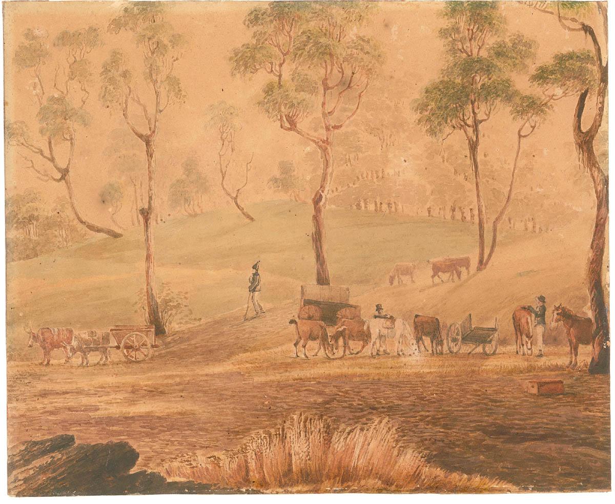
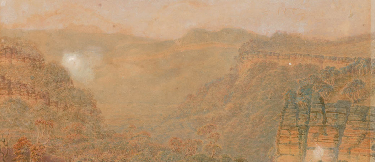
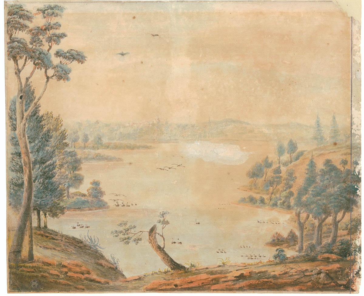
Once in the mountains, the party witnessed first hand the challenges the road builders had tackled, as well as the scenic grandeur. Descending into the grassy plains on the western side of the mountains, they camped on the banks of the Macquarie River for a week. It was during this time that the Governor selected a suitable site for the erection of a town to be named Bathurst. The party returned to Sydney on 19 May 1815.
Major Henry Antill (1779-1852) and John Lewin both kept records of the trip, Antill a journal and Lewin watercolours. Lewin's paintings of the excursion capture previously unrecorded landscapes, and provide some wonderful behind-the-scene glimpses into the organisation needed for the excursion.
Read Henry Colden Antill's complete Journal
View the full collection of John Lewin's paintings
View a chart of part of the interior of New South Wales by John Oxley, Surveyor General
Celebrating the centenary of the crossing
To mark the centenary of the crossing of the Blue Mountains by Gregory Blaxland, William Wentworth and William Lawson, historian, writer and lecturer Frank Walker (1861-1948) wrote the official history, published in 1913 by the Blue Mountains Centenary Celebrations Committee.
To support his research, he amassed a large collection of maps, leaflets, brochures and newspaper clippings. Some of Walker’s collection is held at the State Library of New South Wales.