Collection Item

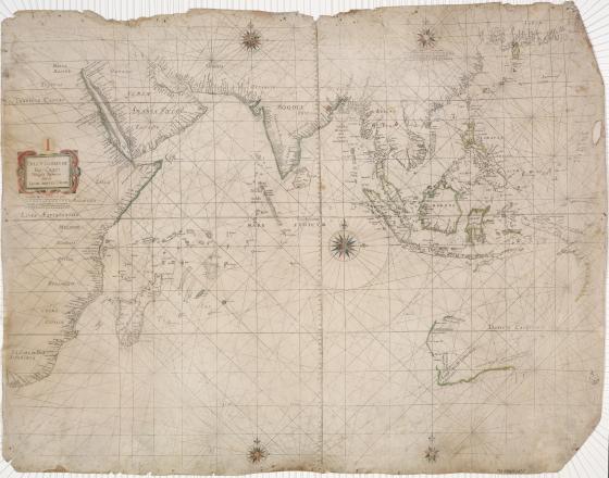
Oost-Indische Pas-Caart Nieulycks Beschreven Door Iacob Aertsz. Colom c 1633
This chart of the Indian Ocean and East Indies is printed on vellum (parchment made from calfskin). Only three other copies are known to exist. It shows European discoveries of the Australian continent made before the voyages of Dutch explorer Abel Tasman in 1642 and 1644. Jacob Aertsz Colom based the information on a map produced by Hessel Gerritsz, chief cartographer of the Dutch East India Company. A primary compass rose sits in the centre of the chart, surrounded by 16 secondary compass points. Interconnecting the compass points are ‘rhumb lines’ which were used to aid navigation and measure a course to be steered.