Collection Item

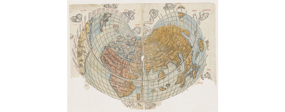
[The World] [cartographic material] 1511
This map is based on the work of Roman geographer Claudius Ptolemy (c 100 – c 170 AD). It also includes European discoveries from the previous two decades, including the sea route to India via the Cape of Good Hope established by the Portuguese explorer Vasco De Gama in 1497. These early maps provided essential information for planning the Portuguese expeditions to India and the East Indies and would have been examined by Italian explorer Andrea Corsali and his contemporaries. Set in a cordiform or heart-shaped design, it is the first map printed in two colours with additional hand-colouring in this example.