
Terra Australis Incognita - the unknown southern land. The existence (or not) of this mysterious, mythical place has intrigued philosophers, explorers and map-makers since it was first hypothesised by the ancient Greeks and Romans. The empire-builders of 18th century Britain were just as obsessed with investigating territories below the Equator.
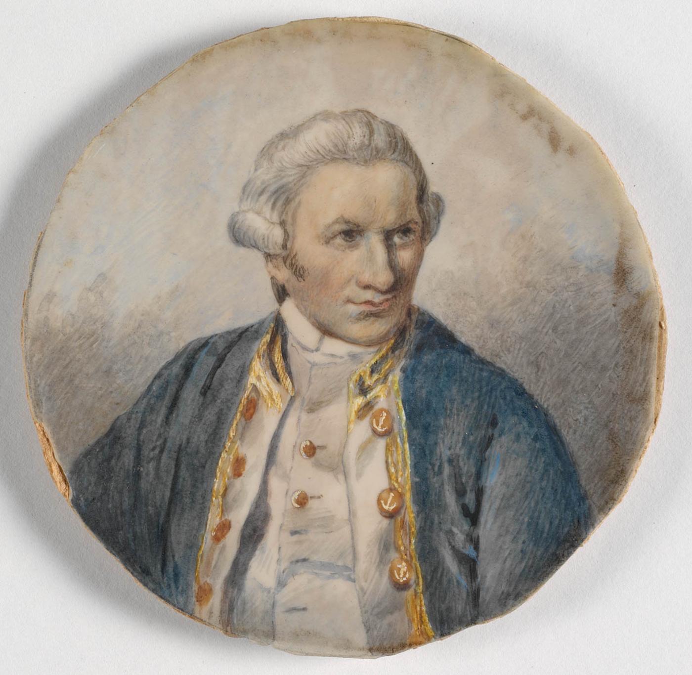
In 1768, when Captain James Cook set sail on the first of three voyages to the South Seas, he carried with him secret orders from the British Admiralty to seek ‘a Continent or Land of great extent’ and to take possession of that country ‘in the Name of the King of Great Britain’.
While each of Cook's three epic journeys had their own aims and significant achievements, it was this confidential agenda that would transform the way Europeans engaged with the Pacific, its lands and inhabitants. The maps, journals, log books and paintings from Cook’s travels are just some of the State Library’s incredible records of this exciting time.
The first voyage
James Cook's first Pacific voyage (1768-1771) was aboard the Endeavour and began on 27 May 1768. Cook’s voyage had three aims; to establish an observatory at Tahiti in order to record the transit of Venus (when the planet passed between the earth and the sun), on 3 June 1769. The second aim was to record natural history, led by 25-year-old Joseph Banks. The final secret goal was to continue the search for the Great South Land.
Cook reached the southern coast of New South Wales in 1770 and sailed north, charting Australia’s eastern coastline and claiming the land for Great Britain on 22nd August 1770.
The second voyage
Cook's second Pacific voyage, (1772-1775), aimed to establish whether there was an inhabited southern continent, and make astronomical observations.
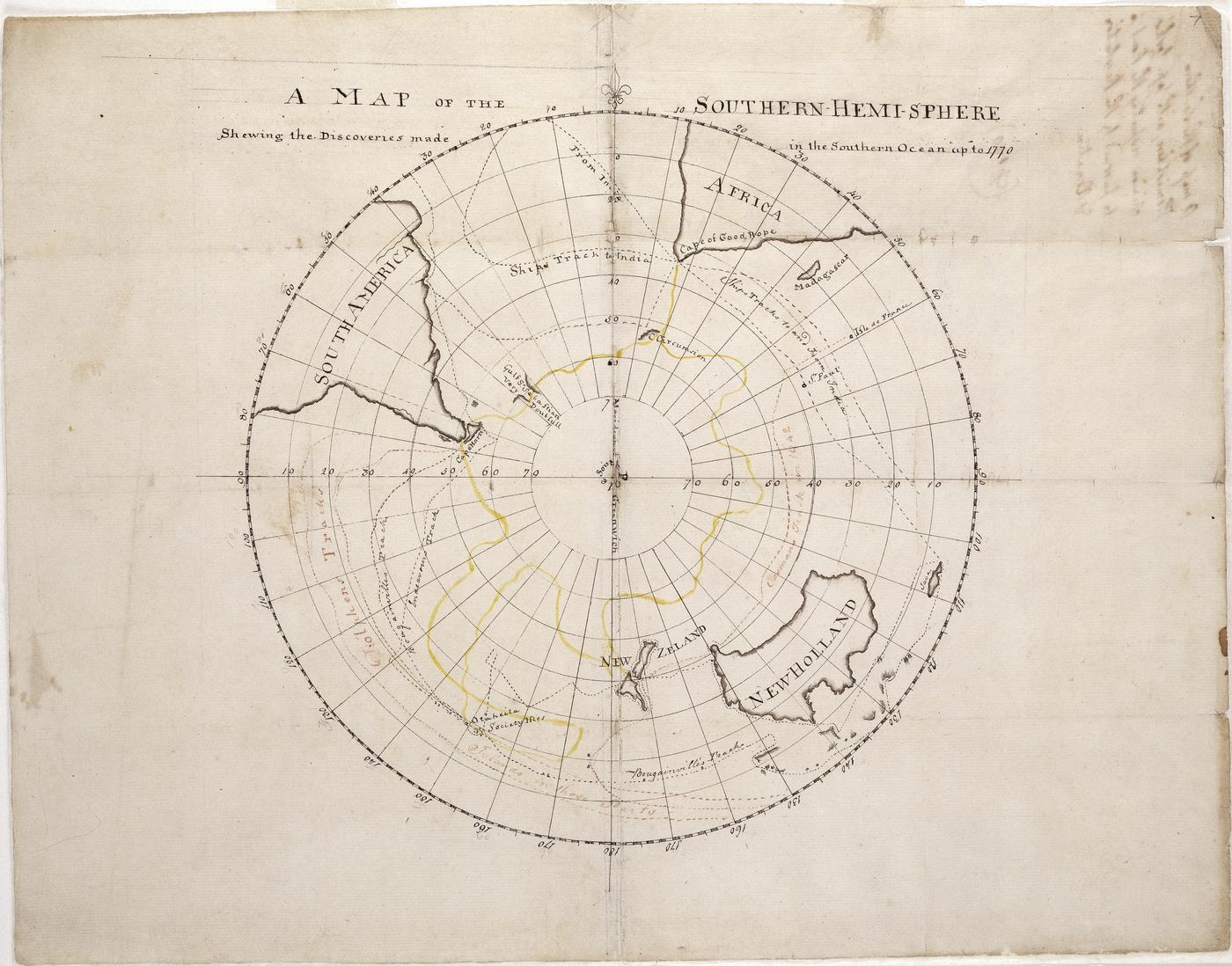
The two ships Resolution and Adventure were fitted out for the expedition. In 1772, before he set out, Cook created a map which showed the discoveries made in the Southern Ocean up until 1770 and sketched out his proposed route for the upcoming voyage. In 1773, accompanied by naturalists, astronomers and an artist, Cook made his first crossing of the Antarctic Circle, claiming that he had been further south than any person. During a voyage of 100,000 km, Cook sailed south of the Antarctic Circle (at 66˚30’S) on three occasions, proving that the southern landmass was neither as large or as habitable as once thought. Cook also discovered several islands along the Scotia Arc, initiating the commercial interest that underpinned much of the focus on Antarctica over the next 150 years.
The third voyage
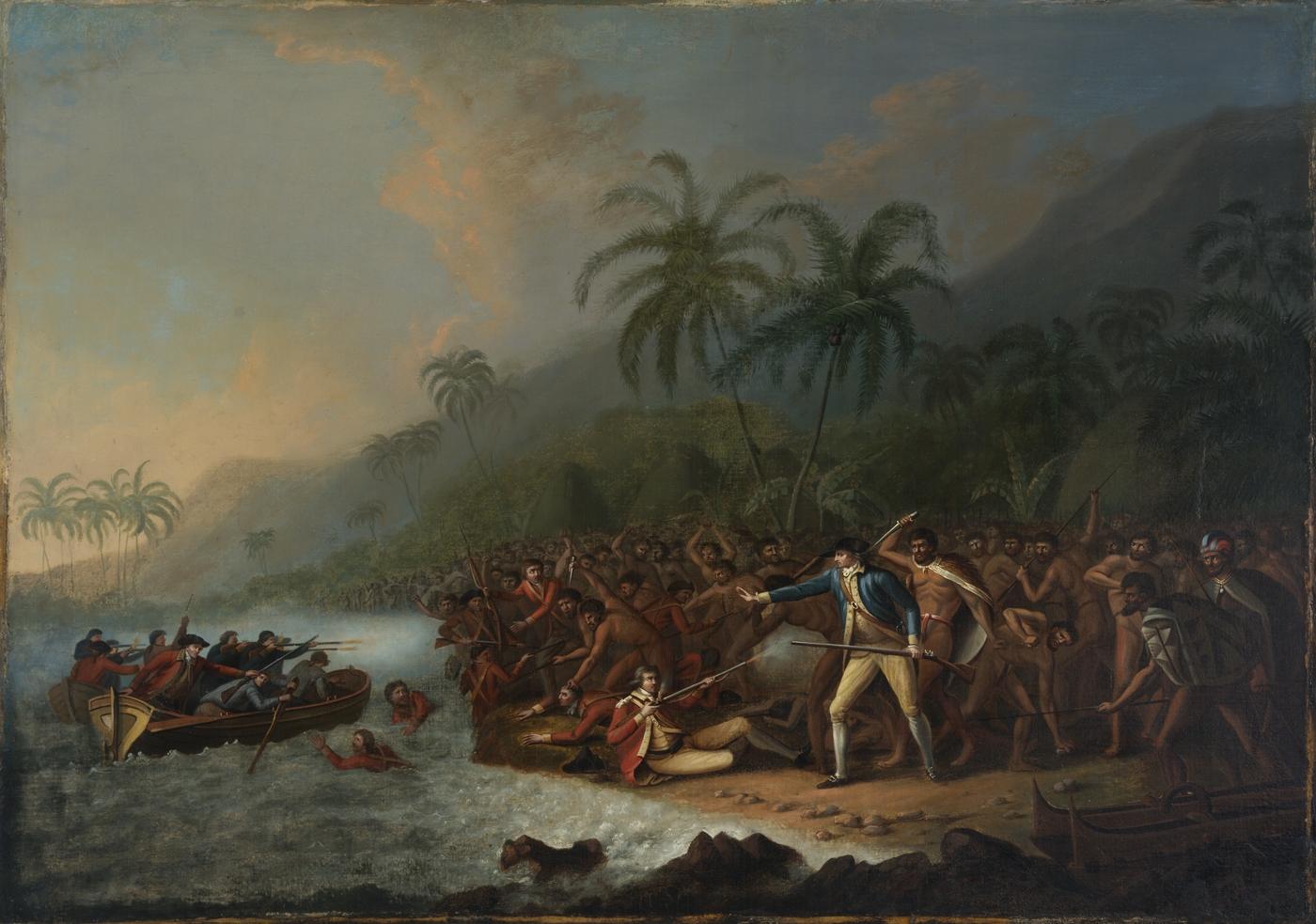
Cook’s third and final voyage (1776-1779) of discovery was an attempt to locate a North-West Passage, an ice-free sea route which linked the Atlantic to the Pacific Ocean. Again, Cook commanded the Resolution while Charles Clerke commanded Discovery. Leaving England in 1776, Cook first sailed south to Tahiti to return Omai, a Tahitian man, to his home. Omai had been taken on Cook’s second voyage and had been an object of curiosity in London. It was on this, Cook's final voyage, that he discovered the Hawaiian Islands in January 1778. This major discovery would lead to his death – Cook was killed on a return visit to Hawaii at Kealakekua Bay, on 14 February 1779.
This story has been developed with the support of the State Library of NSW Foundation.
We would like to acknowledge the generosity of the Bruce and Joy Reid Foundation.