In 1824, Hamilton Hume and William Hovell led an expedition of discovery to find new grazing land for the colony. They and their party trekked south from Appin to Lake George, then on into Victoria, keeping west of the Great Dividing Range and ending up at Corio Bay, on the Victorian coast, where present day Geelong is situated. Hovell mistakenly believed they had arrived at Westernport, and did not realise his mistake until after his return.
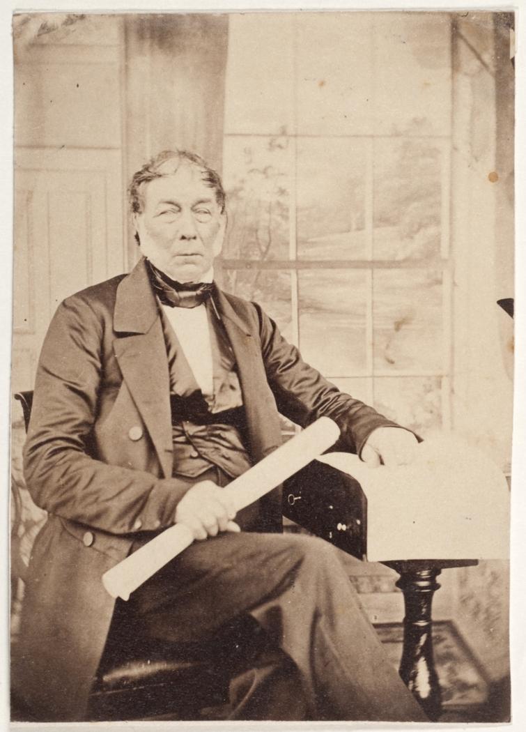
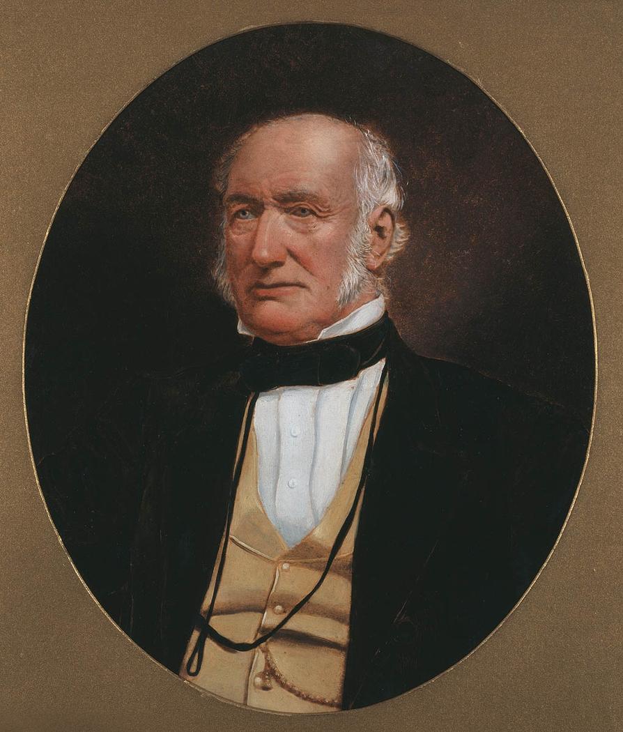
Hamilton Hume was born near Parramatta on 19 June 1797. At fifteen, Hume moved with his family to a large grant of land near Appin, and from the age of seventeen began exploring the land south to the Berrima region. He gained a reputation for his bush skills and knowledge of the area and was asked by Governor Macquarie to take part in several inland journeys to Lake Bathurst, the Goulburn area and south to Jervis Bay, with James Meehan and John Oxley. After an expedition with Alexander Berry, Hume was given a grant of land at Appin where he established a farm. He later acquired land in the Yass district, where he set up a second station. Governor Brisbane wanted to have the land between Lake George and Bass Strait explored, but he was unable to finance such a long and difficult expedition. Hume was inspired to attempt the expedition himself, planning a journey to what is now Spencer Gulf in South Australia, but was also unable to finance the trip. A mutual acquaintance, Alexander Berry, introduced Hume to a former sailor, William Hovell, who lived on his own grant of land at Narellan.
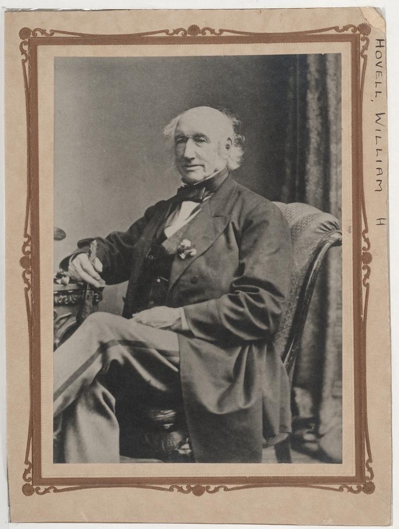
William Hovell was eleven years older than Hume. He was born in Norfolk, England, on 26 April 1786. By his early 20s, Hovell’s career at sea was established, and he commanded a trading ship in South America. In 1813, he and his family emigrated to New South Wales where he worked for Simeon Lord, again as captain of coastal and trans-Pacific trading vessels. In 1816, he left life at sea and took up farming on his grant of land at Narellan. Hovell had made short exploratory trips himself, but his real skill was in navigation. He had also been considered for Brisbane’s unrealised expedition, and offered to take part in Hume’s journey and share the cost. The expedition was mostly financed by Hume and Hovell themselves.
To raise the money needed, Hume sold an imported iron plough – a sought-after item in the new colony – and Hovell sold some of his land. They received a small amount of assistance from the Government stores, including six pack saddles, a tent and some clothing for their convict servants.
They also took a team of bullocks, several horses, and enough supplies for four months, including, as William Hovell documented:
‘640 lbs. [pounds] flour, 200 lbs. pork, 100 lbs. sugar, 14 lbs. tea, 8 lbs. tobacco, 12 lbs. soap, salt, coffee, etc., etc., etc., for myself and three men, together with a musket and ammunition for each man. This is exclusively for ourselves, as Mr. Hume has supplied (as I understand) the same quantity.’
William Hovell, 2 October 1824, Journal, Safe 1 / 32d
On 3 October, 1824, the men left Hume’s farm at Appin. They headed south to Hume’s station at Yass, near Lake George, where the expedition was to begin in earnest. On 17 October, after several days’ rest at Hume’s station, the party set off into areas not yet settled by the Europeans.
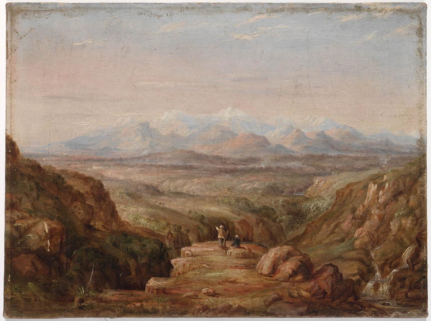
The terrain south was difficult. The expedition had to cross several treacherous rivers, including the Murrumbidgee, where, after several days of planning, the bullock dray was temporarily converted into a punt. The Great Dividing Range also proved difficult. The bullocks had trouble keeping their footing on steep, slippery mountainsides, and Hume and Hovell argued regularly about the best route through the mountains. Hovell was older than Hume and probably used to being in charge. He also had extensive navigational experience from his sailing days. Hume, on the other hand, was arrogant, but knowledgeable about bushcraft and the Australian landscape. At one stage, the expedition split in half, because the men could not agree on the direction to follow. Hovell soon rejoined Hume when he realised that his partner was right, and the expedition proceeded in a relatively friendly fashion. Ironically, most of the credit for the expedition went to Hovell, as the older partner, but it appears now that Hume may have contributed more to the success of the expedition, thanks to his superior knowledge of the Australian bush.
On their return, in January 1825, Hume and Hovell reported their discoveries to Governor Thomas Brisbane. A party (including Hovell) was sent by sea to Westernport to re-examine the fine land which Hume and Hovell had described, and it was then that Hovell realised that the two men had journeyed to Corio Bay in Port Phillip, not Westernport, as he had previously thought. Despite this error, Hume and Hovell's expedition opened the way for settlement around the Port Phillip area, resulting in the founding of Melbourne.
Both Hamilton Hume and William Hovell were rewarded with large land grants for their work, but later a bitter dispute erupted between the two men over their respective roles in the expedition. In an 1853 visit to Geelong, Hovell was celebrated as the discoverer of the region and the press reports enraged Hume, who thought that Hovell was claiming sole credit for their discoveries. Both men published pamphlets giving their versions of the expedition, and Hamilton Hume remained embittered until his death in 1873. William Hovell died in 1875.
'At the end of seven miles a prospect came in view the most magnificent. This was an immensely high mountain covered nearly one-fourth of the way down with snow, and the sun shining upon it gave it a most brilliant appearance. It was surrounded by other irregularly formed mountains, but they did not appear to have any snow upon them on the north side, nor were they so high as the former. The supposed distance is about fifteen or twenty miles. From E.S.E. to S.W. was one continuous range of the highest mountains I have seen in any part of the colony'.
William Hovell, 8 November 1824, Journal, Safe 1 / 32d
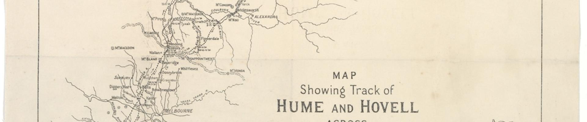
Expedition Maps
The first below hand-drawn map shows shows the route taken by Hume and William Hovell in their 1824 expedition of discovery to Corio Bay, Port Phillip, with surrounding features, and an outline of the coast. It is the work of a professional draftsman. It is thought to have been drawn up in the Lands Department from Hume's orginal map, which he drew during the journey on a skeleton map provided by the Governor. This map is described as 'Hume's own sketch-map', which he gave to Sir Thomas Mitchell but it is more likely that the draftsman was Mitchell himself than Hume. The map was among some of T.L. Mitchell's papers received about 1920 by Mitchell's grandson, G.V.P. Mann. Mann passed the map to Sir William Dixson, whose collection is held in the State Library of New South Wales.
The map is oriented with south at the top and was probably prepared in around 1826, as the explorers' destination is correctly shown as Port Phillip, not Westernport, as the men firstly believed. Hovell confirmed the navigational mistake in 1826 when he visited Westernport by ship.
The second printed map below, published by the Victorian Department of Lands in 1924, shows the track taken by the expedition, and their camp sites.
William Hovell's journal
William Hovell's journal of his 1824 expedition with Hamilton Hume was kept in a small field notebook. He describes the landscape and the tough conditions under which the men and beasts had to travel. These included navigating through rough, mountainous country, swollen rivers, impenetrable bush and dealing with plagues of mosquitoes, sandflies and the irregular supply of fresh game, such as kangaroos and waterbirds. He also makes several references to the importance of the animals which accompanied the party. The bullocks, which struggled up and down uncleared hills with heavy loads, and the dogs which which were essential in killing kangaroos to feed the expedition. Hovell documents the kills made by the dogs, the many injuries inflicted on them by the kangaroos, and their emaciated condition during periods of low food supply when the dogs could only be fed on boiled flour. William Hovell regularly recorded encounters with the Indigenous peoples of the region, commenting on their methods of food gathering, tools used and land management techniques, such as grass burning and damming of rivers to catch fish. He seems to have been respectful and perhaps a little envious of the ability of the local people to live in a landscape he found hostile. One journal entry states:
'Those are the people we generally call "miserable wretches," but in my opinion the word is misapplied, for I cannot for a moment consider them so. They have neither house-rent nor taxes to provide, for nearly every tree will furnish them with a house, and perhaps the same tree will supply them with food (the opposum). Their only employment is providing their food. They are happy within themselves; they have their amusements and but little cares; and above all they have their free liberty.' 29 November 1824