Back in October 2020, Cecilia Harvey and Kate Hughes were hard at work in the Library's underground conservation labs, preparing rare and rarely seen precious objects from one of the world’s great map collections.
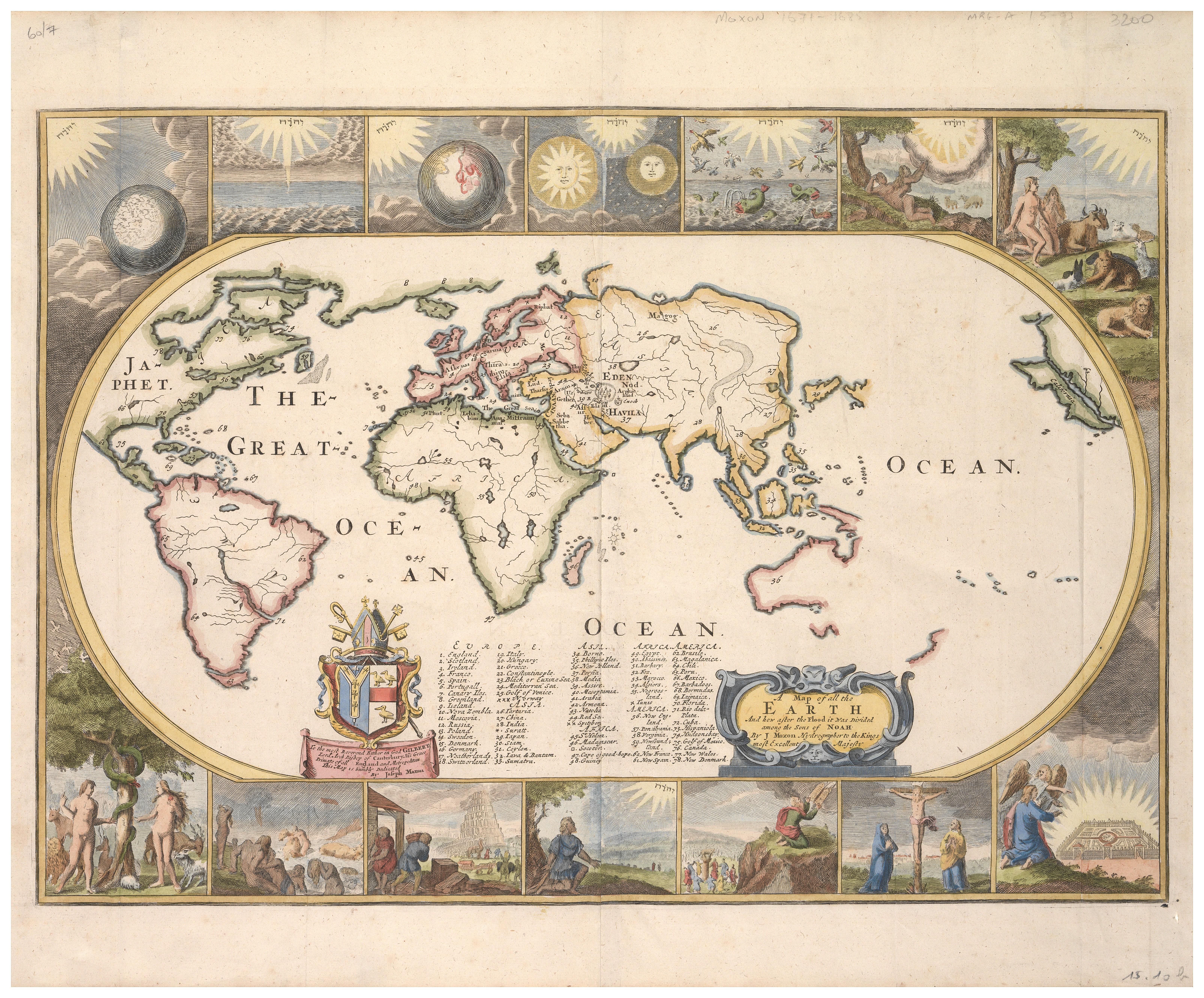
While Harvey was painstakingly coaxing fragments of backing cloth off a 1907 map of Federation-era Sydney, Hughes was restoring a wonderfully ornate map. Depicting the known world of 1671, it is decorated with biblical scenes — Adam and Eve’s expulsion from Eden, Moses with the Ten Commandants, and Noah with his Ark.
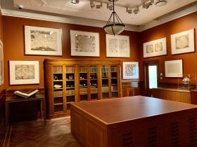
As one of the last island continents to be charted by cartographers, maps have always played a crucial part in our national identity. ‘Our map collection is one of the largest in Australia, along with the National Library’s,’ explains Maggie Patton, the Library’s maps and rare books expert.
‘We’ve chosen 30 maps from our collection to be on the walls, representing five centuries of European mapmaking,’ Patton says, pointing out the Library holds over 200,000 maps, covering New South Wales, the rest of Australia, the Pacific and the Antarctic.
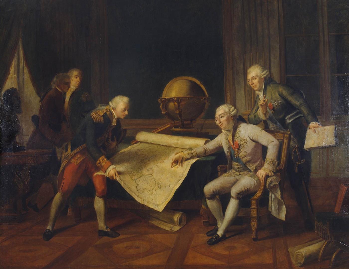
Some of the rarest and most interesting are housed in the drawers of the specially commissioned, beautifully crafted, Australian-made table. However, the first thing visitors will spot when they enter the smaller of the two adjoining rooms is the large copy of Nicholas-Andre Monsiau’s historic painting of flawed colonial ambition. Painted in 1911 from the 18th century original, it depicts Louis XVI of France, the indecisive last Bourbon king (still best known for being married to Marie-Antoinette). Ironically, he’s shown giving the Comte de La Pérouse sailing instructions. ‘Look’, he seems to be saying, ‘this bit of the Pacific seems to be unexplored: why not go there?’ Famously La Pérouse arrived in Botany Bay just a few days after the First Fleet, giving his name to a Sydney suburb, before mysteriously disappearing mid-adventure.
One of the more surprising inclusions in the first Map room — a newly acquired treasure — is an exquisitely crafted silver punchbowl the size of a supermarket watermelon. Commissioned by botanist Sir Joseph Banks for Cook’s second voyage, Patton says, it was probably designed to swing on a rope net in the officers’ quarters of HMS Resolution. ‘But the Admiralty threw Banks off,’ Patton continues. ‘He was just demanding to take too much on the voyage.’
The second, larger room — with a huge digital screen showing other highlights from the Library’s cartography collection — is devoted to charts and maps of early NSW and Sydney, with Flinders’ ‘Terra Australis’ taking centre stage.
Many ancient civilisations have cherished maps: ‘They show your position in the world, and where you want to be,’ Patton explains. As such they are a documentary interpretation of the human spirit. The oldest surviving ‘world map’ is generally considered to be the ancient Babylonian Imago Mundi, dating to around 600 BCE. ‘Each map tells a visual story,’ Patton continues. ‘Who commissioned the map? Why? Is the map a claim about ownership? Or documenting recent discoveries and future ambitions?’
Steve Meacham is a freelance journalist whose work regularly appears in leading Australian and British media outlets.
This story appears in Openbook Summer 2020.
Map Room Highlights
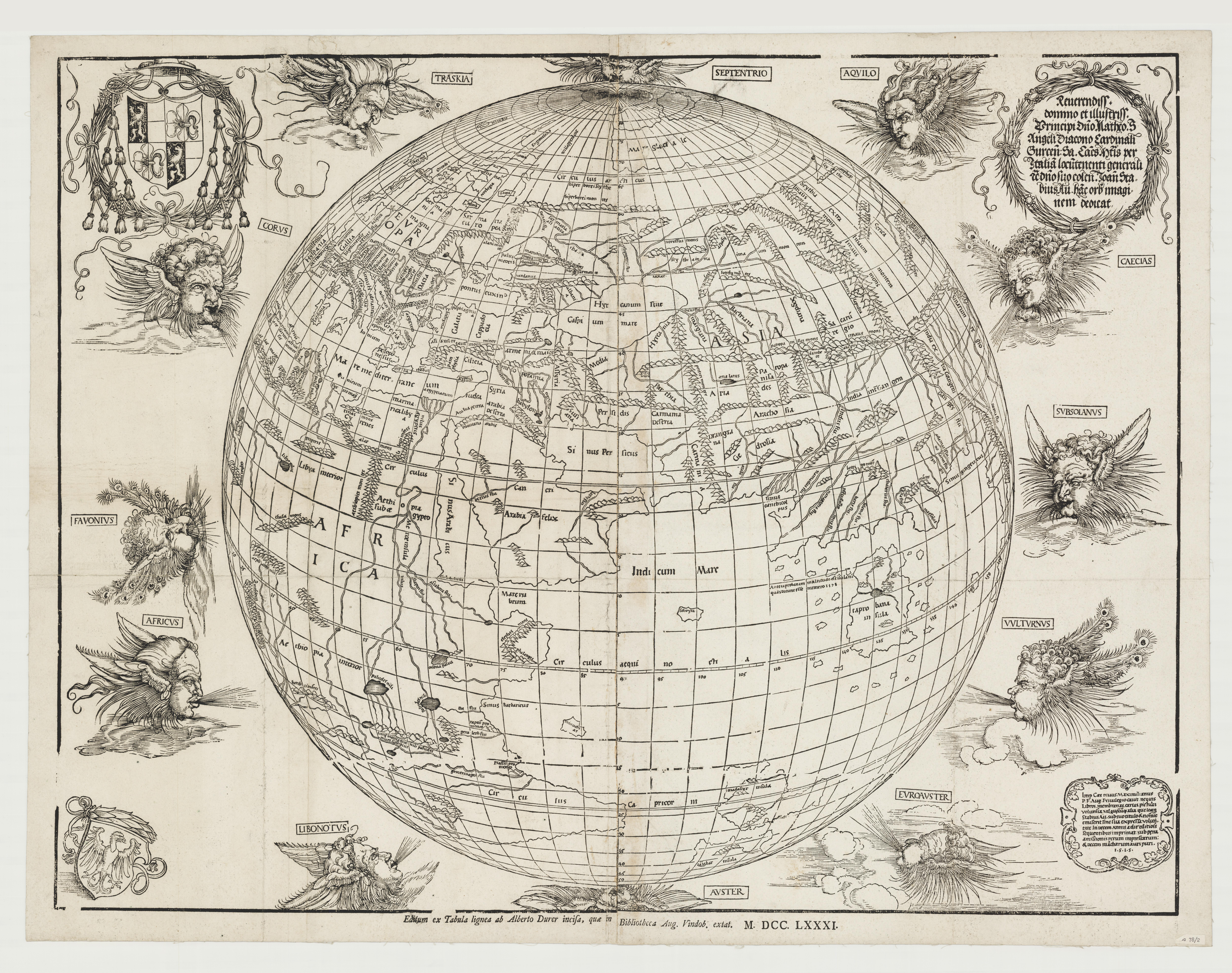
1. Stabius Map (longer in Latin), 1781 (reprint of 1515 original), by Johann Stabius, Austria
Stabius was court astronomer to Maximillian I, Emperor of the Holy Roman Empire (1508–1519), and his 1515 original is one of the first depictions of the Earth as a globe. Albrecht Dürer, the court artist, drew the decorations of the classical 12 winds. The original woodblock was found in 1781, and this is one of very few prints from this edition.
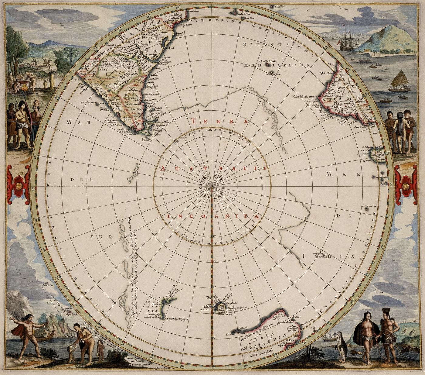
2. Polus Antarcticus, 1657, by Jan Jansson, the Netherlands
This map was created after Abel Tasman's voyages to the southern hemisphere. It shows the tips of South Africa and South America, plus the coastline of ‘Nova Hollandia’ the Dutch had discovered, with the ambition to explore Terra Australis Incognita (today’s Antarctica).
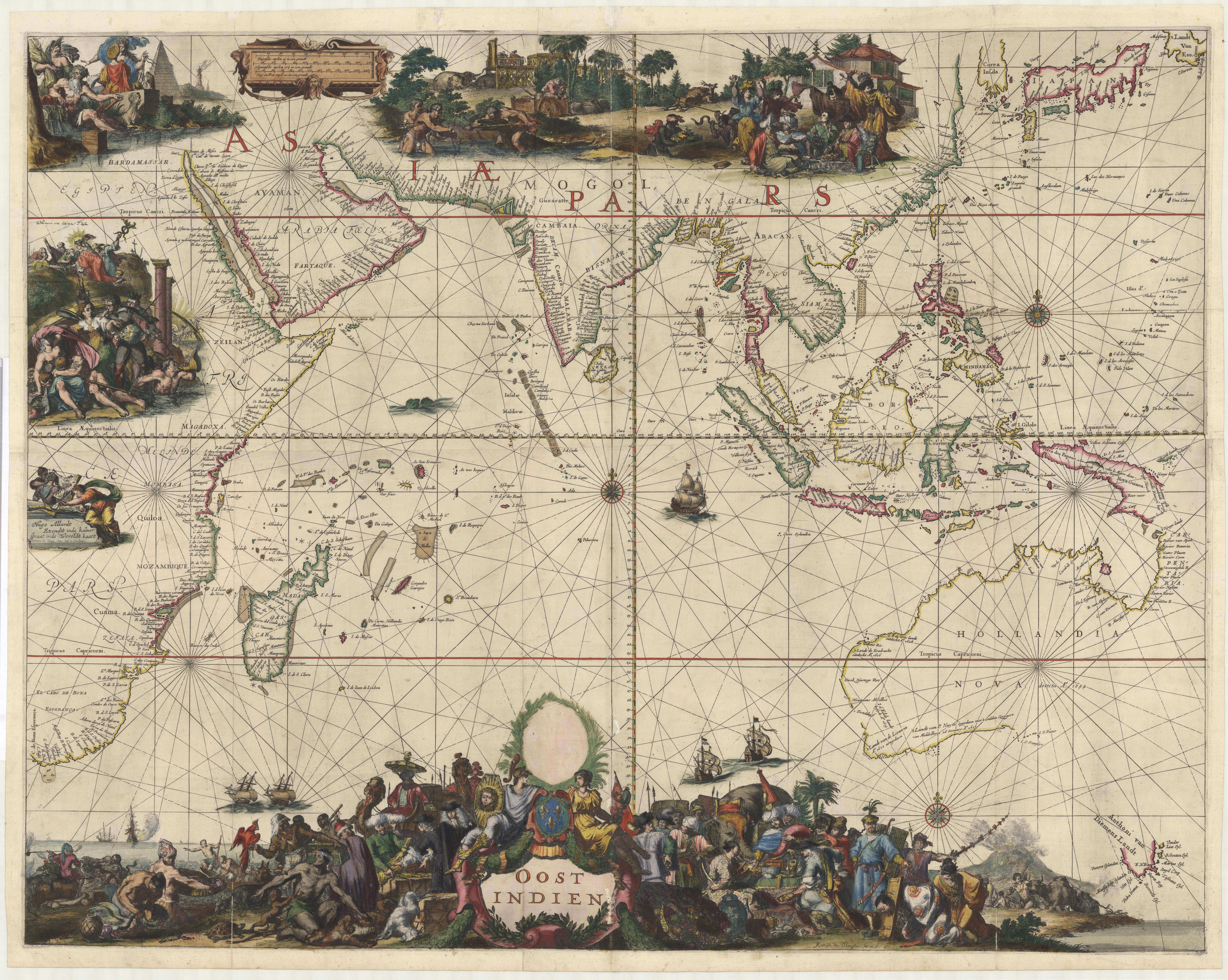
3. Oost Indien, c 1668 by Hugo Allardt, the Netherlands
This very rare map encompasses the trading territory of the Dutch East India Company and the discoveries made by the Dutch in Australia before Cook, plus latitude and longitude marks. It also includes superb cartouches by Romeyn de Hooghe, a Dutch Baroque artist and engraver who included indigenous people in his decorations. Japan and South Korea are mere approximations.
4. Map of all the Earth and how after the Flood it was divided among the sons of Noah, 1671, by Joseph Moxon, England
This shows the Dutch discoveries post- Tasman, but before Cook’s first voyage. Look at the illustrations around the map, showing scenes from the Bible, from the Creation to the story of Adam and Eve. Now look at the map itself which shows the location of the Garden of Eden.
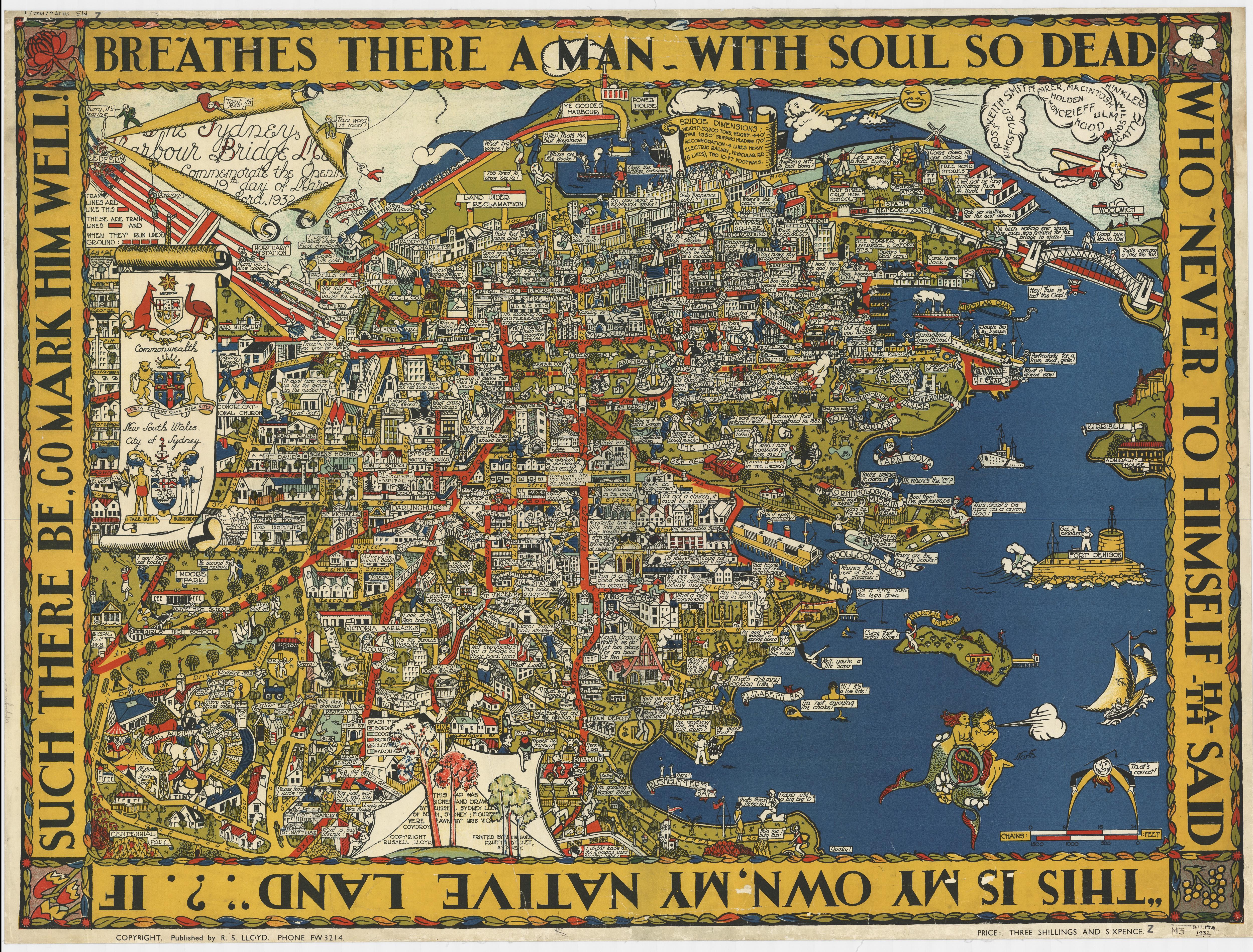
5. Sydney Harbour Bridge Map, 1932, by Russell Sydney Lloyd, figures drawn by Victoria Cowdroy, Australia
This is a commercial map published to commemorate the opening of ‘the Coathanger’. It’s full of in-jokes like ‘If this isn’t a church it must be a pub’. But it accurately shows Sydney as it was. Garden Island is still separated from the mainland, and Bennelong Point is home to the Tramshed, not an Opera House.
The Map Rooms are made possible by the State Library Foundation.
![The City of Sydney [a bird's-eye view]](/sites/default/files/styles/banner/public/slnsw_fl12541655.jpg?itok=DKvOVGHr)
